
SEAiq apps replace ActiveCaptain with Waterway Guide
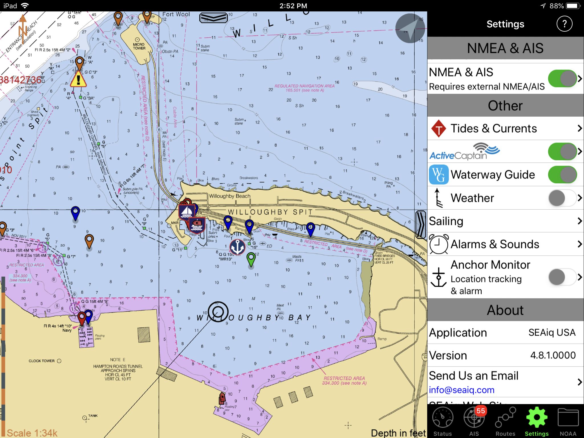
Actually, as you can see above, SEAiq lets you overlay both ActiveCaptain and Waterway Guide info onto its chart display (and easily turn either or both overlays on and off). But as noted on the SEAiq website, the AC data will not be updated after May 23, though “We are considering updating SEAiq support for ActiveCaptain but do not have definite plans yet.”
As Panbo has been reporting, third-party app support for AC is uncertain for a couple of reasons, but I’m hoping that it will turn out to be reasonably easy for developers to adopt Garmin’s new AC data distribution system (and free licensing requirements). In fact, I’m hoping to see SEAiq and other apps able to display both AC and Waterway Guide info well into the future. There is some overlap, suggested above, but the data is being sourced in two distinct ways, each with pros and cons.
-
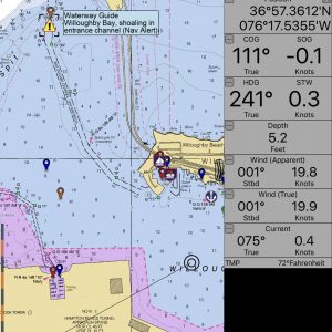
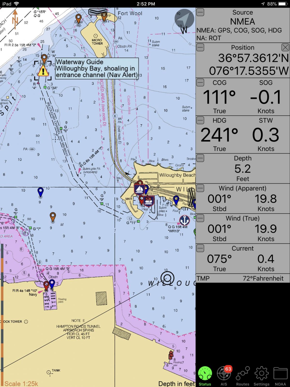
- Waterway Guide Nav Alert shoaling
-
- WG shoaling marker detail
-
- ActiveCaptain Hazard
-
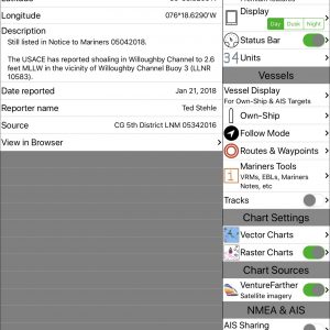
- AC shoaling Hazard detail

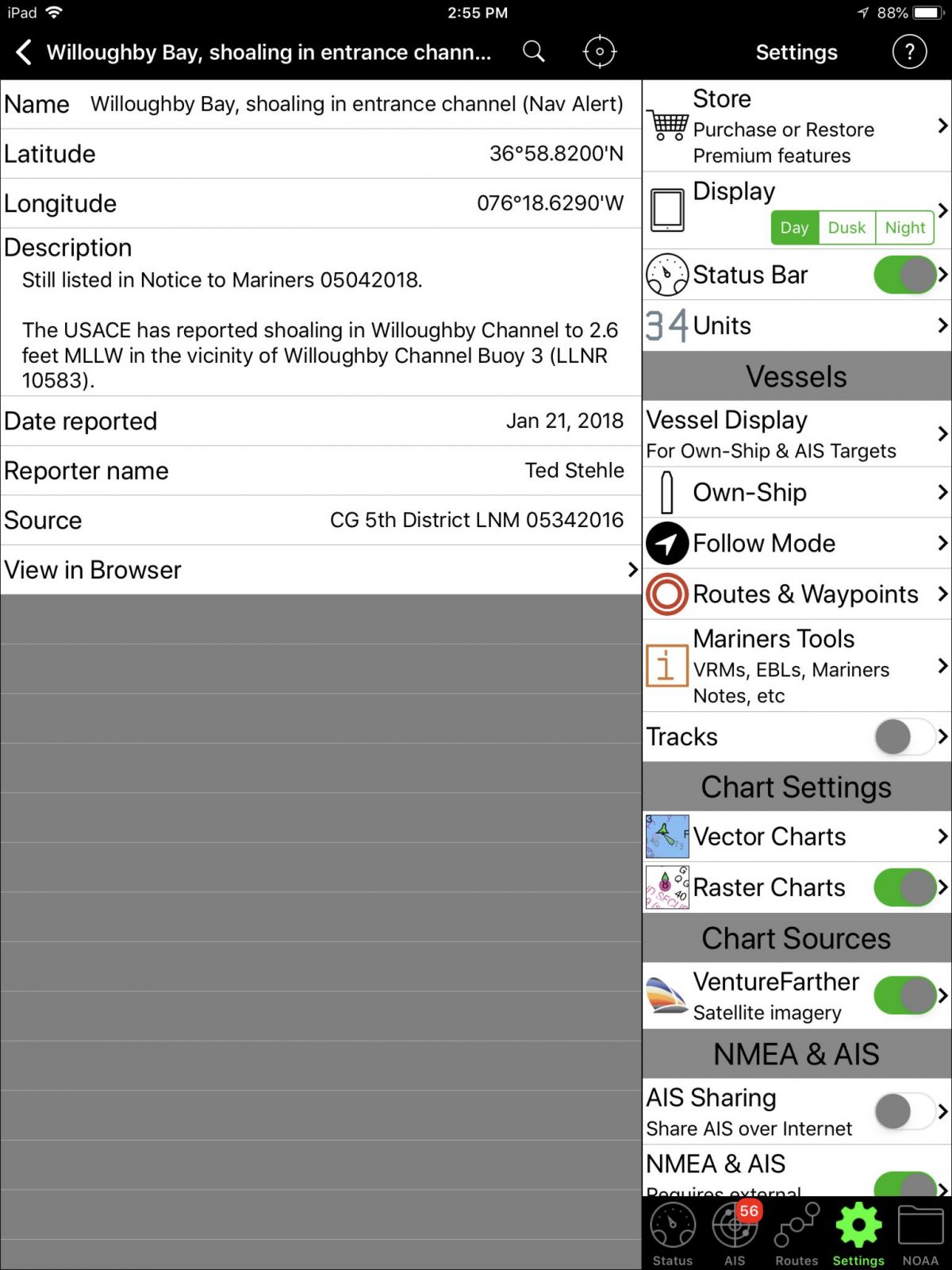
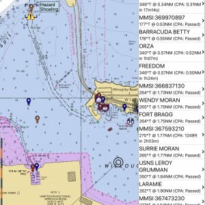
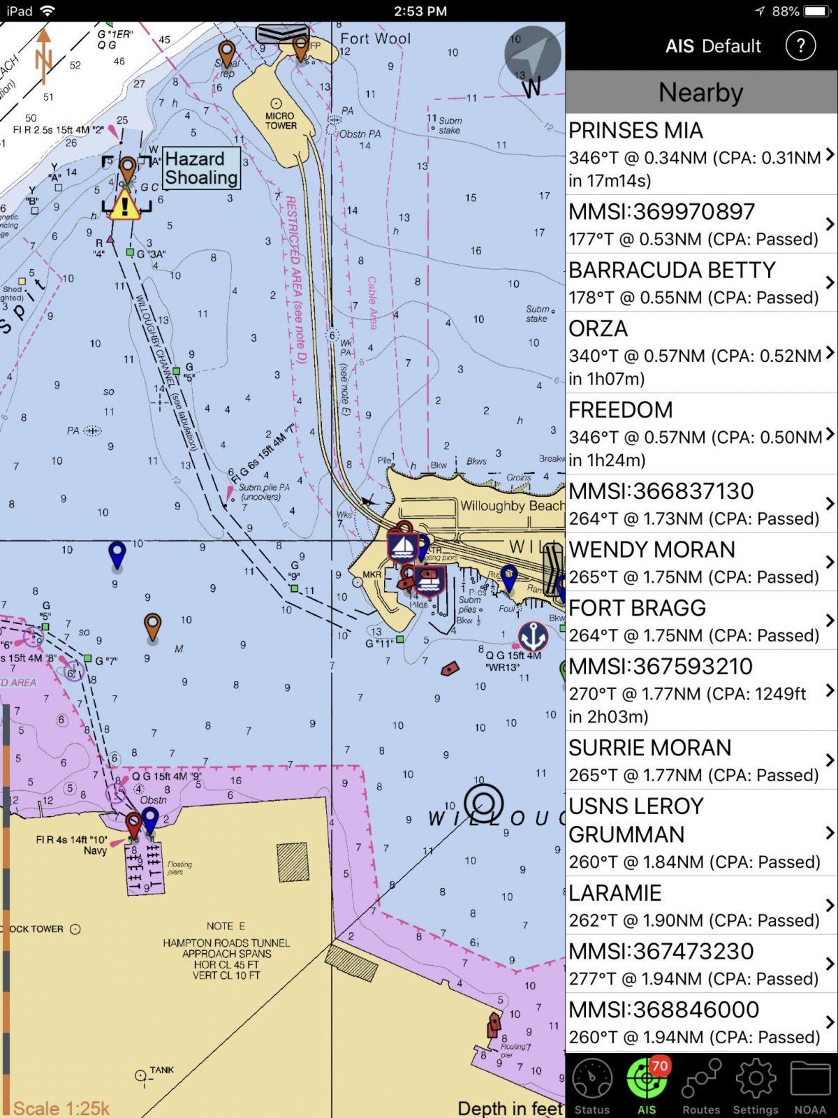
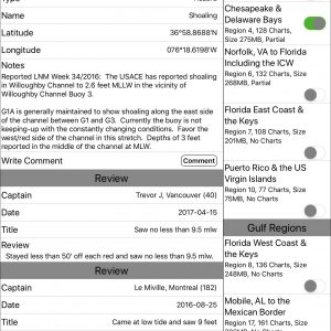
The four SEAiq iPad screens above show how the publication WaterGuide and the crowdsourced ActiveCaptain Community each handle a shoaling situation along the main channel into Norfolk’s Willoughby Bay (where Gizmo and I are waiting out a sou’west blow). I like the distinctive WG Nav Alert icon, and especially appreciate the Local Notice to Mariner’s detail that was entered by a professional editor, who also recently updated it. Now in this case, an AC captain also referenced the (original) LNM — and it’s quite nice that some other AC contributors reported on how well the added green can keep you in deep water, as it did for me this morning — but in my experience, AC Hazard info is pretty hit and miss.
For example, if I end up having to run some of the New Jersey ICW, it will be interesting to see if the few (but edited) WG Nav Alerts actually outperform AC’s way-too-many Hazard markers (you’ll have to pan/zoom the AC Livemap to Atlantic City, as it doesn’t seem to support location links anymore). I know from past experience that the AC shoaling warnings are often redundant and/or quite outdated, and the difficulty of using so many while also negotiating the skinny NJ ICW made me wish AC had pro editors.
-
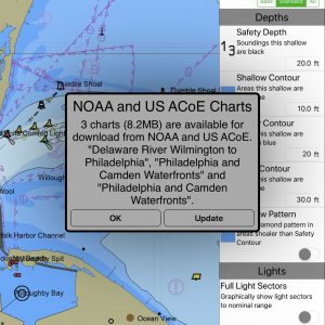
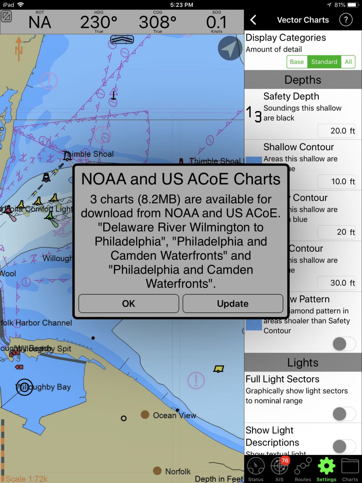
- Automatic NOAA chart updating
-
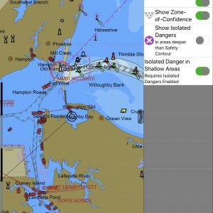
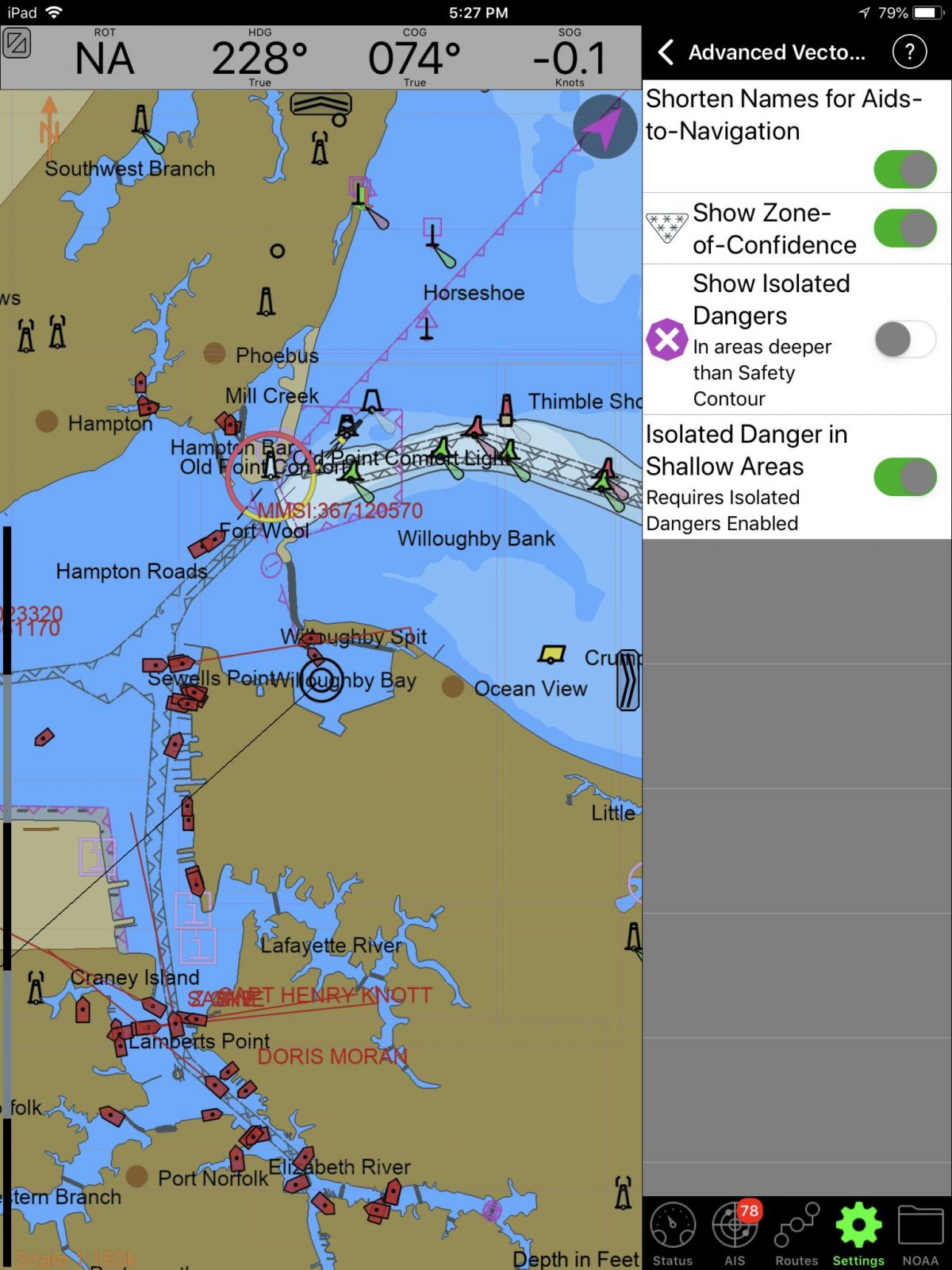
- Advanced vector chart controls, with ZoC’s!
-
- Position your AIS antennas with finger tip

-
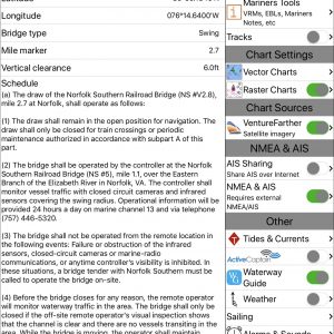
- Also, Waterway Guide has great bridge info

I hope you’ve also noticed in the images that SEAiq can do a whole lot more than showing WG and AC data, and get this: All the iPad screenshots here were taken using SEAiq USA, which costs just $5 (after the 7-day free trial) with access to all NOAA vector and raster charts. (There’s also supposed to be an Android version but I can’t find it). {Clarification 5/16: there is no SEAiq USA for Android.}
SEAiq’s main market is professional pilots, and even the recreational versions have a serious mariner feel, as I’ve tried to illustrate with some of the extra screenshots. I’ve noted the app’s excellent NMEA data over WiFi abilities in the past, for instance, and I think that SEAiq is the first charting program to display NOAA’s valuable Zones of Confidence. I haven’t figured out how that feature works yet, but I’m going to test the app some more.


There is some confusion about the SeaIQ app at the Android site. One is listed for $49.99 and another listed for $399.99. Both are offered by Sakhalin LLC. The more expensive version seems to have a few more features. Darned expensive for an app!
Bob, the $50 version is for international use and supports all sorts of chart formats. The $400 version has special features for ship pilots and apparently is quite popular for that demanding use. You’ll find the same at the Apple Store, but what’s missing at Google Play is Android USA for $5.
So there’s no $5 SeaIQ USA for Android?
That’s what I’m seeing in the Google Play store, not available. I’m not sure if this is intentional or not but it’s not there.
The SEAiq site is not clear about it, but I’ve confirmed that there is no $5 USA version for Android.
Well, that’s a shame. For $5 I’d roll the dice to see what it’s all about. But not for $50, especially if it includes coverage for areas I’ll never use.
When I downloaded SEAiq for evaluation, I was presented with the upgrade screen for $49.99 in order to get:
Waypoints and routes
Tracks
AIS with CPA
Weather
Anchor alarm
Plus other enhancements
Since a navigation app without waypoints, tracks or routes would not be useful to me, I bought the $49.99 upgrade. The on screen message in SEAiq implied the $4.99 version had none of the above. Is this not true?
Did you download SEAiq USA, Bob? It has routes, anchor watch, tracking, etc. And I only recall the $5 choice when I bought the “premium” features.
The title shown on the icon I have loaded is “SEAiq USA”. I was given a choice (after the 7 day intro period) to buy the $4.99 version or upgrade to the $49.99 version. According to their in-app purchase description, only the $49.99 version had the premium features (routes, waypoints, tracks, AIS, weather, etc.). I have a screenshot of the in-app purchase screen but there’s no way to attach it in the post.
I’m checking with the developer, but I think you purchased standard SEAiq. Do you see lots of chart format choices?
Also, please send me the screenshot: [email protected]
Ben, you are right. I just downloaded SEAiq USA onto another of my iPads and when I went to the upgrade screen, that charge was only $4.99 instead of $49.99. Regardless of the icon name of SEAiq USA that I originally downloaded, somehow I must have loaded the international version and paid the $49.99 price.
If you have or want to use nv Charts then the Sea IQ you have is what will work. Also, anyone racing to Bermuda can use the nv Charts with Sea IQ. This is one of the least expensive chart options for that destination
Sorry for your wallet, Bob, but glad to hear that the mystery is solved. I also received confirmation from Mark at SEAiq:
“$5 version has all recreational features, such as routes, tracks, anchor watch… the $49.99 version is only needed if charts other than free ones from NOAA/USACE are required.”
I updated the app feature spreadsheet to reflect the $4.99 price for SEAiq USA. . I’m trying to keep the spreadsheet accurate. Any new download of the spreadsheet off the Waterway Guide site will have the change.
Bob, thanks for all the work you’ve put into your apps overview and spreadsheet. And here are the links for interested readers:
https://www.waterwayguide.com/latest-news/news/8865/14-ipad-navigation-apps-evaluated
https://drive.google.com/file/d/1BKMJxPECvglkSV70Yj8242wj8g8oYQVm/view
(For me at least, opening that spreadsheet in Google Sheets makes it easier to read all the valuable notes.)
I just mounted my iPad at the helm with a powered USB to keep it running. The first app I pulled up was SeaIQ. I like the app and look forward to working with it this summer on my cruise to Maine. In the past, my experience with the print version of Waterway Guide has been dismal. After several write ups had wrong or old phone numbers and marina info I gave up on using these volumes and took them off the boat. On the other hand i’ve experienced old hazard reports on AC, particularly in my home waters – in some cases very old which is of no help to me. I totally agree that crowdsourced AC and Waterway have to be professionally edited to keep them useful.
Well, I did end up in the New Jersey ICW and the issue of useless ActiveCaptain Hazard Markers seems even worse than three years ago. Here’s what I just posted on the first shoaling hazard if you’re headed north from Atlantic City:
“ALL the shoaling hazard markings going north are outdated!
Maybe they recently dredged, but I just ran north from Atlantic City to Long Beach and did not see ANY shoaling at even ONE of the many ActiveCaptain Hazard Markers. I have four separate sonar systems on my boat, including side scanning, and even more chartplotters. So I’m pretty confident that I was right in the channel and did not miss shallow spots.
Even if this section of ICW was dredged recently, I fear some these hazard marks still indicate a problem with ActiveCaptain. I saw at least one severe shoaling warning that was started in 2013 and almost immediately contradicted by other Captains. Why is old, disproven data still in AC?.”