
Who’s driving that big rig (#1, AIS who?)?
I have a great deal of respect for professional seaman, but, like the rest of us, they do screw up. Unlike the rest of us, they are driving very massive vessels. In April 2005, for instance, the container ship Lykes Voyager, en route to Vancouver at 19.5 knots had a fender bender in a foggy Taiwan Strait with another container ship, the Washington Senator, which was Hong Kong bound at 17 knots. “No one was hurt but both ships were damaged and a number of containers were lost overboard.” Imagine the sound! As usual the MAIB (the UK’s Marine Accident Investigation Branch) has produced an amazingly detailed report on just what happened, available in several PDfs. Noteworthy items as drawn from the report by Digital Ship:
* “Using the VHF radio, the master of the Washington Senator had agreed to a starboard to starboard passing arrangement with another vessel that he mistakenly thought to be the Lykes Voyager – he was, in fact, conversing with another unidentified vessel.”
* “The use of the radio as the primary method of communication for a distress call after the collision was also ineffective according to the investigation, as there was no response from any other vessels or from the search and rescue (SAR) authorities.” (They used 16, not DSC!)
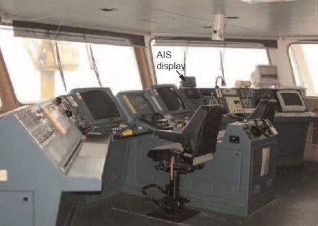
* “Even though both ships in this case were fitted with AIS equipment it was not utilised for identification – if it had been the Washington Senator could have easily identified which ship it was speaking with, and the incident could have been avoided.” (Both had only MKDs to track AIS targets, which—in other words—were not integrated onto their radar or chart displays.)
We need to think about realities like these even as we get excited about Class B transponders. And thank our lucky stars that we weren’t in a small boat trying to avoid these behemoths that foggy morning off Taiwan.


")


WHat is amazing is how incompetant these captains and navigators are with all their expensive gear. One would think that they would use EVERY redundant means they have to confirm the situation. But they DON’T.
I feel vert uncofortable around these huge vessels.. I don’t feel they are watching out. Where was their AIS alarms?????????????????
I can not believe the utter amatures that installed the AIS onboard that vessel WE ALWAYS interface AIS with Radars / ECDIS on large vessels
While I’ve seen mis-programmed “static” data before, I recently saw what I believe was an erroneous position report.
While sailing from Hawaii to San Francisco a couple of weeks ago, I was passed by a cargo ship about a mile north of me. His position as reported by AIS was about a half-mile *south* of me.
When I noticed this, I captured enough AIS and NMEA data from my system to be able to look at in detail later. He was reporting that he was operating in high-accuracy mode, so I don’t think I was seeing a dead-reckoning error.
Has anyone seen this type of error before? Anyone care to suggest an explanation? I am discussing this in rec.boats.electronics now, if you would like to chime in there.
Thanks,
Paul
(sorry if this posts twice — I’m figuring out how to use the TypeKey thing)
Yes I once watched an AIS target (122′) track right through the middle of Treasure Island in San Francisco Bay. I was located on the Oakland Estuary so I could not see the target. The position was updating at the standard AIS dynamic data rate. Only saw this once.
Interesting… Any suggestions as to the reason for this position error, other than “broken GPS” which seems unlikely? I see no configuration error that would cause this.
I wonder if some AIS systems may not correctly report when the GPS fix is lost?
-Paul
I have found a possible explanation for the position offset error I saw (see my earlier post). “Dave” in rec.boats.electronics noticed an AIS-reported position error in a number of boats. It turns out they were using a Furuno GPS receiver with a user-programmed lat/lon offset to compensate for a local chart datum. This could definitely cause the problem I saw.
Here are some U.S. Coast Guard and Furuno documents that discuss the problem:
http://www.uscg.mil/hq/gm/moa/docs/1-05.pdf
http://www.uscg.mil/hq/gm/moa/docs/furunosafety.pdf
Regards,
Paul