
Saildocs, a Gram Schweikert tutorial

Saildocs is the baby of West Coast weather guru Jim Corenman, who with the support of SailMail provides a free e-mail server able to feed low bandwidth weather data (and more) to boaters. While not as pretty as the free, but limited Grib.us {or similar PassageWeather}, or the costly but widely used OCENS WeatherNet {or ClearPoint}, it provides a multitude of weather data in many formats right to your in-box for free. All of the Saildocs instructions can be retrieved by e-mail ([email protected]) or from their not-really-meant-for-surfing Web site. Below are my brief tips and tricks to using Saildocs:
Saildocs is best known for delivering GRIB (GRIdded Binary) weather files {which require some sort of software viewer to use), but it also serves NOAA text forecasts, NOAA Weather faxes, as well as some West Coast private forecasts, BBC world news, and Sailing Scuttlebutt.
All requests are made by email to [email protected]. The Subject may be anything you wish to help you find it later in your mail box. The text of the email is where you make your requests. You may request multiple items, by typing another command on a new line. There are two basic types of requests, “SEND” or “SUB”. Send will request a file for immediate retrieval one time. Sub will set up a subscription (default: 14 days) that will be delivered every time the product requested is updated. The number of days can be altered by adding a “days=xx” after the request command. There is a very handy “interval=1” command that can be added to send the file as soon as it is updated (not published in the help files). Alternatively you may set the time each file is to be sent with a “time=xx:xx” added to the end of the request. Following the Send/Sub command is the product name. To request a GRIB file you would type:
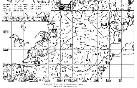
Send gfs:44N,40N,72W,67W|0.5,0.5|0,12,24..180|WIND,WAVES
or
Send coamps:44N,40N,72W,67W|0.2,0.2|0,12,24..72|PRMSL,WIND
Saildocs hosts GFS, COAMPS, WindWave3, NoGaps, & QuickScat surface weather data as well as the Hycom RTOFS Ocean Current data that I’ve found to be a great free Gulf Stream resource (and persuaded Jim to add to the Saildocs Library for convenient retrieval). The command for the current model would be:
Send rtofs:44N,40N,72W,67W|0.1,0.1|0,24..120|
All the GRIB models follow the same format: Model: Lat/Long| resolution (degrees)| model forecast times (hours)| parameters requested, all with no spaces. Subscription commands are added with spaces between.
Non-Crib products are also available and very helpful. High resolution (at least high enough), but highly compressed, weather faxes can be requested by using the TIFF file name used at the NOAA Weatherfax Web site. A full listing of the weatherfax file names are available here. Similarly, text forecasts (same as read by “Metal Mike” on the radio) are available as well. Atlantic weather codes are available here. Example requests would be:
Send PYAA02.tif
Send FZNT23.KWNM
There are lots more available, so I suggest you poke around the Saildocs product index or request the document by sending an e-mail to [email protected] and typing “send index” in the body.
Lastly, you can request web pages be sent to your inbox, but I would highly suggest only using short URL’s. If the URL you want is long, I would suggest creating a link with TinyUrl.com as the address needs to be on one line and typos are easy. In the last Marion-Bermuda race we received the tracking results once a day by setting up a subscription to the iboattrack tracking page:
Sub http://tinyurl.com/2sl32q time=12:00 days=6
While the text output is horribly formatted, it was possible to pull out the position data for the boats of interest and see how we were doing. Certain pages certainly come out better than others, but the web-page took FOREVER to load on the {Globalstar} sat phone while the e-mail downloaded in seconds.
My final tip is to make a text file or send yourself an e-mail with the requests you use often and have been successful with. This way you can just copy and paste into a blank e-mail without any thought (except maybe to change your position area if you are sailing longer distances).
Hope this helps you all explore Saildocs. It is a wonderful service and you can’t beat the low low price of free. This is one case where you certainly DON’T get what you pay for.
**************************************************
This guest entry was written by Gram Schweikert who is a naval architect/marine engineer (check out this PDF presentation on the Navy 44), and also a heck of a navigator/weather guy. I know that for sure because I sailed up from Bermuda with Gram and his step-dad on Visions of Johanna, just after the dynamic duo had placed Third in Class A against fully crewed yachts. At any rate, Gram and I were emailing last night, trying to help the Flash of Beauty crew, who were struggling a bit with Iridium/OCENS/MaxSea. It turned out to be a very, very rare case of WeatherNet server failure, but look what you and I have now learned about Saildocs. Heck, I just “sent” for that fax below and it arrived in moments, and it suggests that FOB has some good sledding ahead. How about a big virtual round of applause for Gram, and Jim Corenman! — Ben


I’m glad to see that Jim’s baby is now advertised for just anyone to use … it previously was for Sailmail members only, as I recall. Anyhow, I have been using grib files from Saildocs for years and recommend Jim’s “Viewfax” viewer … I like it better than the Passage Weather display since it overlays wave and pressure data. For the stand-alone viewer (doesn’t require the installation of the Airmail program) go to http://www.siriuscyber.net/wxfax/ and download the beta copy at the bottom of the page (currently version 5.0.035.
Terry
Wow, a much better explanation of saildocs than what I posted to my blog. A lot of extras I did to know about. I am going to have to play around with the weather faxes and NOAA images. Thanks for the great write up.
Darley
For Mac users, GPSNavX/MacENC has the ability to request GRIB files from SailDocs. It provides the user an easy interface to make the request for a GRIB file. The GRIB file is then overlaid on the marine navigation chart.
MacWX is the Mac OS X client for the OCENS WeatherNet service. MacWX is optimized for lower speed connections such as those of cell, satellite, or HF. OCENS WeatherNet offers thousands of weather products including GRIB files.
I use Expedition (www.iexpedition.org)for viewing my Grib Data (and processing weather routing). At work I use the free version Expedition LT (www.iExpedition.org/Downloads/ExpeditionLT_v1.0.6.zip)
The download doesn’t seem to be listed on the website text anymore, but is available for download and is also linked to and hosted by ProGrib (www.progrib.com) as well.
It is one of the better viewers I have played around with, able to show many layers (Surface Prssure, Wind, Current, Rain, Air Temp, Sea Temp, Sig Wave ht, Mean Wind Waves, 500MB, 1000MB, SSH deviation, & Mean Wind Wave Period) and even has a simple C-map world chart.
It has a simple
This is not weather related but… Is there an inexpensive (freeware/shareware?) program out there that displays currents graphically?
Raul
I assume you mean Tidal Currents. Expedition LT will display currents from a grib file, but I have only found ocean currents available this way. Full Expedition (and many other charting software) shows tidal currents as well, but is far from free.
Jim Corenman’s contributions to sailing and communications are broad and deep. I’ve used saildocs, Airmail and Winlink and I’ll take this opportunity to thank you!
I thought that name looked familar … I haven’t seen Gram since our days back at Webb. He came up with an ingenius way to watch movies through his computer with one of the first video input cards/tuners.
Well nice article, even though I have yet to sail far enough for where weather routing and grib files need to be used. … After all the naval architects delmia, work in an industry you love, yet be compensated so little it takes you years (or decades if your lucky enough to design yachts) to make enough to ever own a boat.
I have assembled a Grundig YB 400PE and a Metz weatherfax antennae connecting to my PC. What is the most user friendly software I can use to download weather data. I am not very knowledgeable in this area. What does it mean that the carrier frequency is 1.9 kHz below the assigned frequency.
Thanks for the help.
Hello,
Is ther a way to have in the same grib COAMPS wind, waves and direction and the curent of RTOFS ?
Best regards
Hello,
Yes – you just load all the files into the viewer.
Nick
You can also retrieve the OSCAR ocean current model which is generated by Earth Science Research (ESR) by using OSCAR as the leading term
Send OSCAR:44N,40N,72W,67W
While OSCAR is lower budget than RTOFS and NOAA’s HYCOM model, I’ve found the equatorial currents to be much more accurate than RTOFS even though you only get a 1 day snapshot compared to the many future time slices and high resolution of RTOFS.
Also see http://www.svsarana.com/oscar
Mark, have a look on JVCOMM32,
http://www.jvcomm.de/index_e.html
It used to be the best decoding software for me.
I am not using the PC’s soundcard anymore to decode weather fax and RTTY messages, as there is a much better and simpler solution:
http://www.wetterinfobox.com/english/WIBE.htm
This box stores FAX/Navtex/RTTY messages 24/7 and you connect your Laptop via USB to download the messages from its memory. It has a great SDR receiver and the price is reasonable. And the best: You do not have to manually program the frequencies or forecast schedule – you just tick the boxes for the forecasts you want.