
C-Map lighthouse, not as bad as it seemed

NavSim sent me a screenshot (above, and full size here ) from its latest BoatCruiser software, which now supports C-Map Max charts…and there—unlike the shot I put up yesterday—is the Curtis Island light. That got me investigating. I discovered that if I zoomed in tighter in PC Planner the light suddenly appears. So it is there in the data, though it certainly should appear in the zoom level I showed and in even larger area zooms. I also found a picture of the same Max card being used in a Standard Horizon plotter last summer (below), and the light is showing. I don’t have a C-Map compatible plotter here to see if disappears inappropriately as you zoom out. It’s nice, by the way, to be reminded of those tracks I made last season.
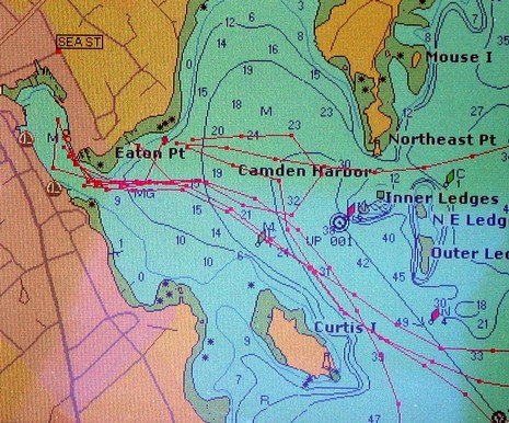


Curtis Island light and the entrance to Camden Harbor: soon to be the best marked channel on electronic charts in the world…