
Gizmo south: TFU, IBEX, NMEA, HSR & other self promotions

I didn’t write the seminar title, but I do understand the value of a grabby headline and I’m excited about being part of the entirely revised TrawlerFest in Baltimore. Paul Comyns and I will make a valiant attempt to cover all the important electronics bases for the knowledge-hungry, long-range-cruisers-to-be that tend to take the all-day “TF University” courses. An interesting added challenge for the presenters is to provide money-saving tips. I’m already working on concepts like how GPS, AIS, and improved signal processing have made it possible to “make do” with a smaller radar, but please suggest other reasonable cost-cutting strategies. And TFU is just the beginning of my fall speaking engagements, one or more of which you might want to attend or at least kibbutz about…
On Friday morning, 9/26, I’ll present a TrawlerFest two-hour seminar titled “The Wonderful World of Onboard Wireless” while Gizmo will be on display along with other power cruisers new and used during the Thursday-through-Sunday “show” portion of TF. Sailors, by the way, are explicitly welcome. Schedules, exhibitors, and seminar info is all here, and everything takes place at the BMC HarborView Marina, which seemed like a very pleasant spot when I used Baltimore’s excellent Waterfront Promenade to walk there from another marina in September 2012.
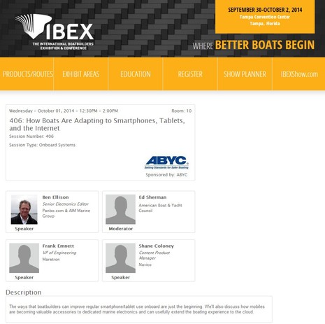
Personally, I’ll have to leave TrawlerFest a bit early for a flight to Tampa where I’ll join a group of other BWI writers to look carefully at all the entrants to the 2014 IBEX Innovation Awards. The judging job wraps up just as IBEX itself gets underway on Monday the 29th, and then I’ll get to be a show/seminar attendee as well as a participant in two seminars I helped to organize with ABYC’s Ed Sherman. The first (seen above) is “How Boats Are Adapting to Smartphones, Tablets, and the Internet” and the second “Interfacing, Alarming, and Logging Engine Data.” In both cases I think we have an expert and diverse panel and we’re working together now to create cohesive presentations. The IBEX audience will be quite different than TrawlerFest’s, but there is overlap in that some technologies important to boaters should be more important to manufacturers and boat yards (and vice-versa). So feel free with your thoughts. IBEX exhibitors with particular expertise in these seminar subjects are also encouraged to be in touch (ben@panbo.com) as I’ll be compiling lists of suggested booth visits for the attendees.
Remember, too, the 2014 IBEX Connected Boat demo pavilion discussed here in May. I notice that it’s now sponsored by Simrad but remain optimistic that its spirit will be all inclusive. It’s also good to see that NMEA is delivering a three-hour super session entitled “NMEA 2000: Saving Time, Money and Resources with a Connected Boat From the Factory.” Rumors persist that eventually the annual NMEA Conference will take place in conjunction with IBEX, and isn’t that idea potentially excellent for lots of us working in many aspects of the trade?
This year, though, I’ll return to Gizmo in Baltimore for a few days before flying to Fort Meyers for the NMEA 2014 Conference & Expo. Fortunately, given the packed schedule seen above, I’ll be at NMEA without any presentation or judging responsibilities. Of course, I’ll be on the hunt for new and interesting products, but I also welcome invitations to chat about this or that. (Or go out on a boat demo, which is pleasantly possible at both NMEA and IBEX this year 😉
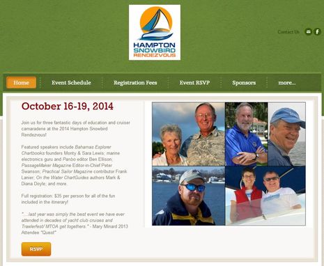
Going to NMEA may mean missing both the Annapolis Sailboat and Powerboat Shows, though it would be fun to watch the changeover again. But stops are uncertain as Gizmo and I motor down Chesapeake Bay to the Hampton Snowbird Rendezvous. I’ve never been to this relatively new event but hear it’s low key, fun and populated with lots of experienced cruisers. Thus, my relatively short “Smartphones and Tablets Aboard” seminar on Saturday, 10/18, may have an audience somewhere between TrawlerFest and IBEX in terms of experience.
So, please speak up about any app or app/hardware integration that you think your fellow boaters should know about. Or that you think developers should be working on. Easy, inexpensive ways to improve Internet connectivity will also come up in some of these seminars; what’s working well for you?
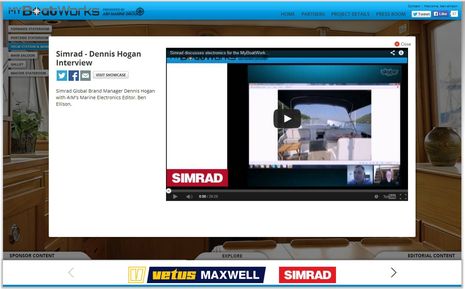
Finally, I’ve got one last bit of self promotion that you might enjoy right now. MyBoatWorks is a web project that’s begun documenting the refit of a 1996 Grand Banks 42. I like the visual site design a lot and if you register and poke around you’ll find a Skype interview I had with Simrad’s Dennis Hogan about all the different ways NSS evo2 gear could be used at both helms. For me the June conversation was somewhat theoretical, but now that I have evo2 at both of Gizmo’s helms, plus tablets, I can attest to the system’s flexibility.


Ben, Looking forward to seeing you at Hampton. My hope is that we are able to get into how tablets can integrate into the navigation system of the boat overall. And of course that we don’t get bogged down in the argument of whether tablets (and other iThings) should be used for navigation at all.
All sounds good to me, Arch.
A pity all the action is on the East coast.. I’d love to see you on the left coast, Ben (tho you’ll have to make it fairly soon – we’re moving aboard and sailing away by next summer..:-).
Sounds as though you’ll have fun Ben! I’m not going to IBEX this year, though, since we are on the other side of the pond (as you probably know). Just now we are in Delfzijl, but moving to Groningen and on to Leiden shortly.
Thanks, Michael; I’ve been enjoying your blog posts and many photographs. Great to see Barbara traveling some of the byways you designed her for many moons ago. Also just thought to add Barbara to my MarineTraffic “Fleet” and find I can now animate your track for 60 days back (if you were being picked by shore volunteers).
And congrats to Hartley on the “sail away” plan.
I’ll bet both of you have ideas about how keep your electronics at reasonable cost while also up to snuff. Please share.
I think you meant “kibitz about”, as “kibbutz” is a sort of cooperative farm. ;^) (I’m an editor; I can’t help myself!)
Ben, Just a comment on the iPad used as a navigation tool – Last year I tried using an iPad Air with Garmin, BlueChart aboard a sailboat in the PNW for navigation. It worked well enough to save the day, however, in my opinion the iPad will never replace a sunlight readable chartplotter in an open cockpit. I found the display totally washed out in even overcast weather. Had to find shade below deck or under a dodger in order to read what was on the screen.
When Tablets add a sunlight readable display they will become a serious navigation tool. In the mean time, they are just a second rate backup. Same goes for cellphones. I’m always shaking my head whenever I see someone trying to read the screen on their iPhone on a sunny day. When will Apple realize that people use their iPhone outside in all kinds of weather? We are not stuck in a vacuum inside a building in Cupertino.
Hi Ben,
The best trick I have for keeping costs down is to use a PC instead of a dedicated chartplotter. All the rest of my instruments are discrete units that talk to each other only as necessary. This also lets me use a BIG screen, so I can see detail over a pretty big area.
Using a PC also allows me to run PC-Navigo over here — with its database of about all European canals.