
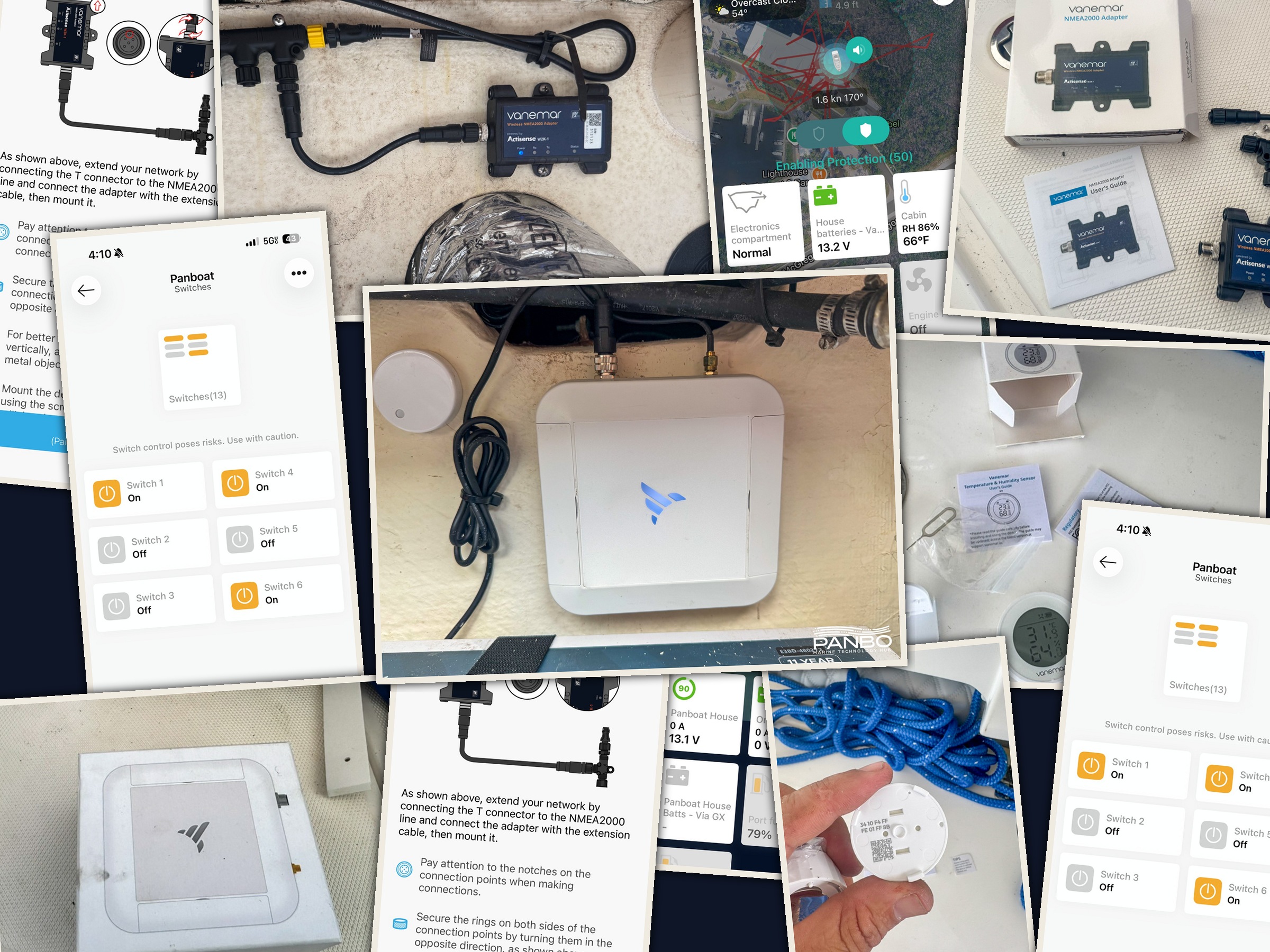
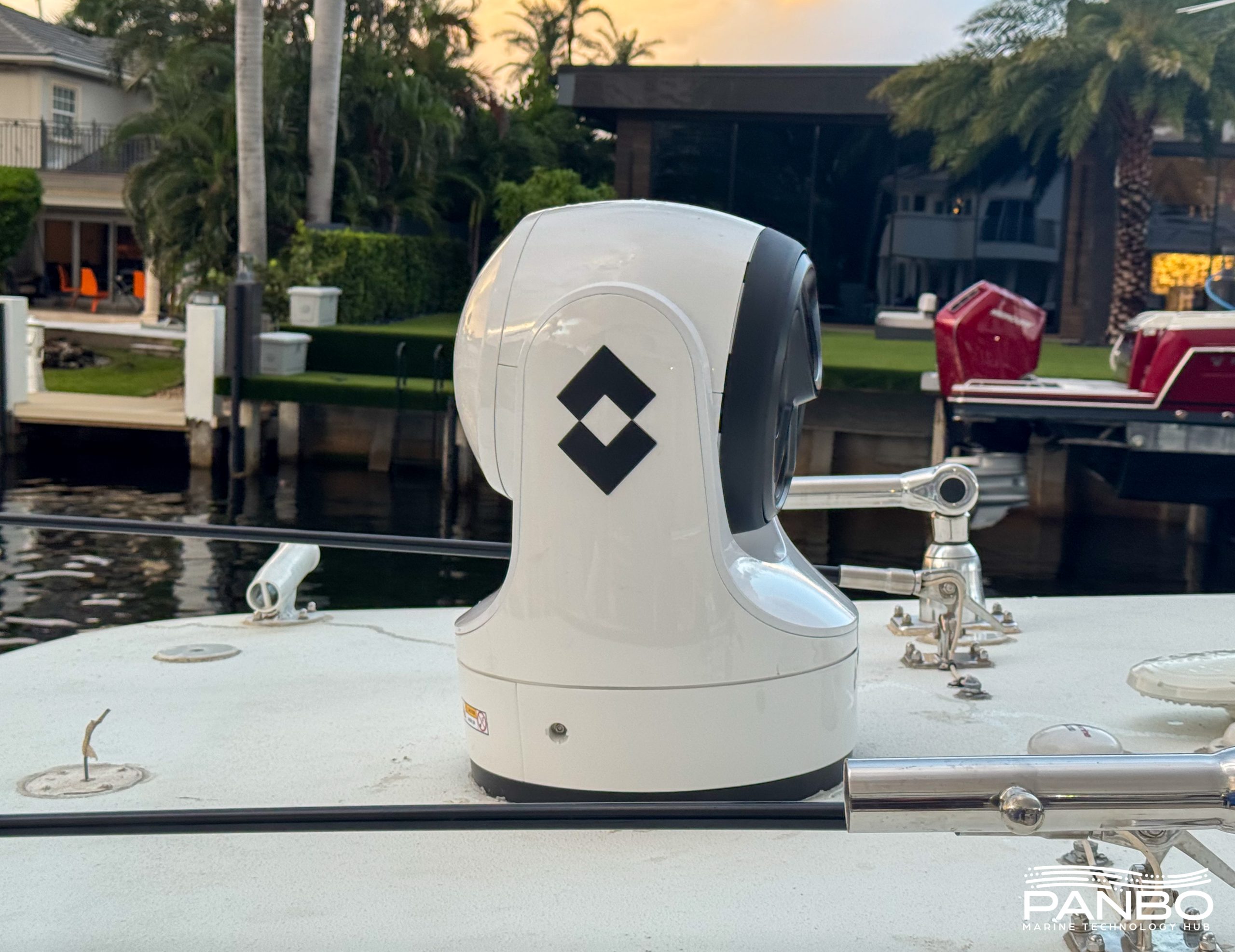
Vanemar Boat Monitor: Slick wireless monitoring, with a catch
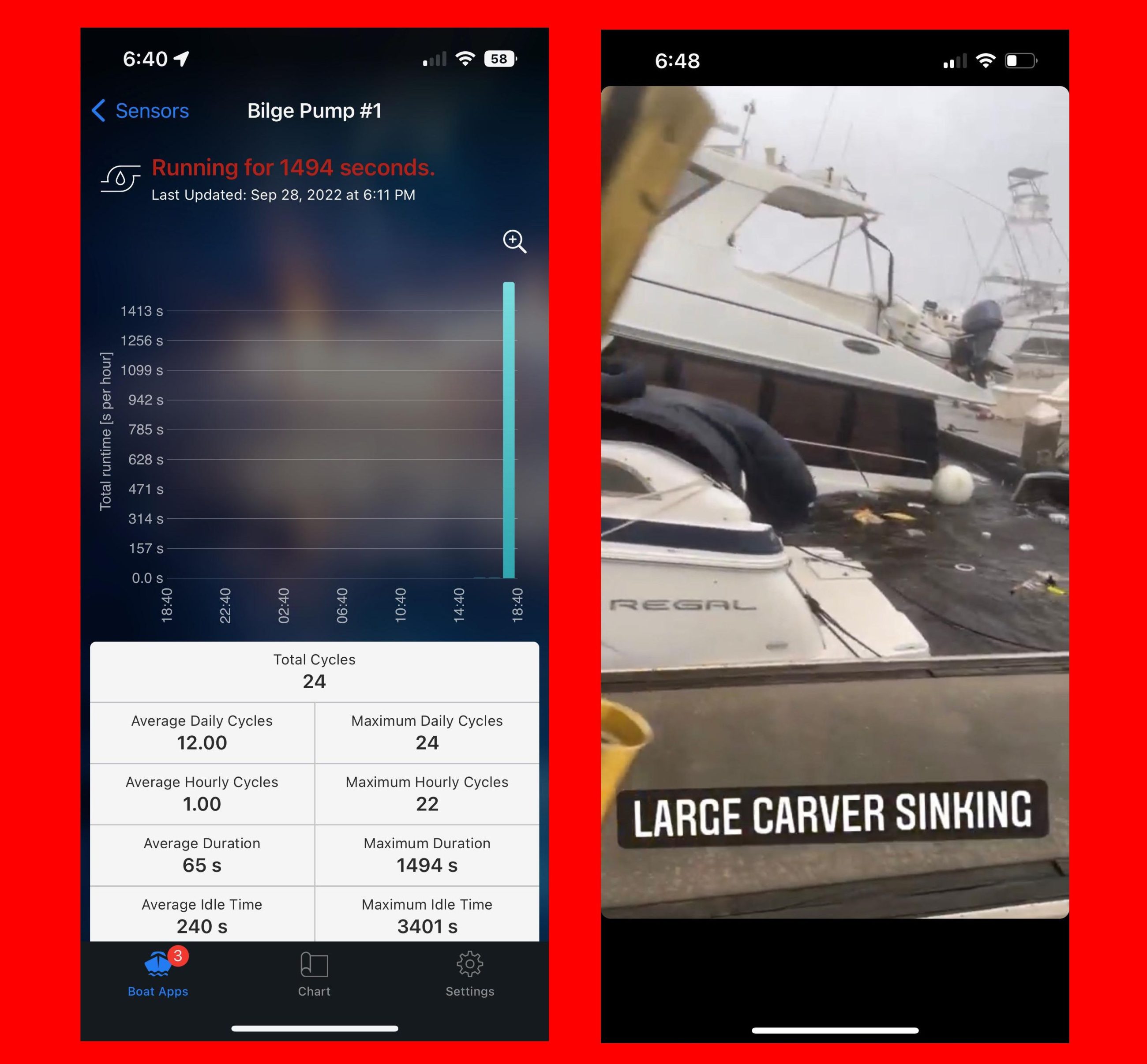
Vanemar’s monitoring system joins a rather crowded field of monitoring products with their own spin on how best to monitor your boat. With a strong reliance on wireless sensors, extensive NMEA 2000 integration, and an emphasis on user experience throughout the product, Vanemar makes their case for consideration when selecting a monitor. But, currently the lack of bilge pump monitoring holds me back from a full throated recommendation.


Recent Panbo Comments