
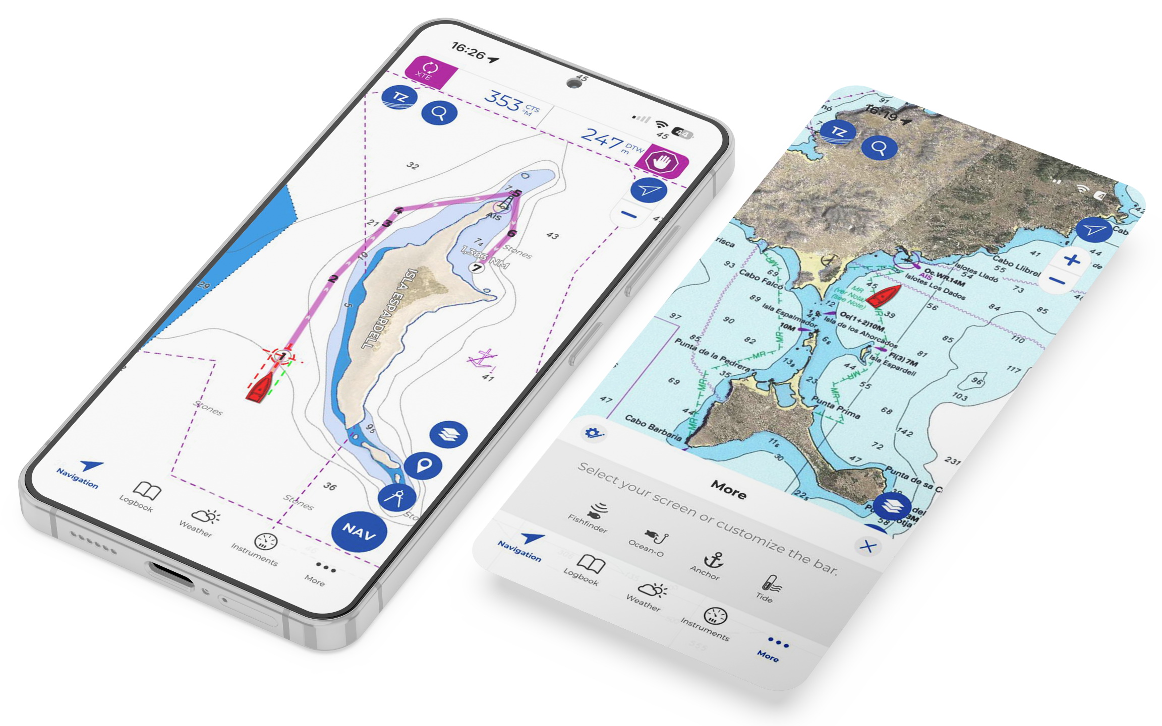
TZ iBoat 4 comes to Android with a redesigned navigation experience
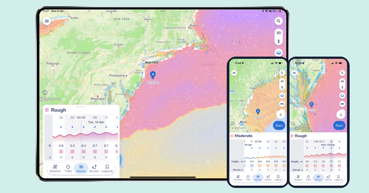
Nobletec today announced the release of TZ iBoat 4, a major update to its mobile navigation app, now available on Android for the first time. This update introduces a new design and a reimagined navigation experience, along with key features and enhancements designed to better support users at sea. The new design delivers a more intuitive and streamlined experience, allowing users to move seamlessly between dedicated screens, each tailored to a specific use. Enhancements to the Weather feature bring…


Recent Panbo Comments