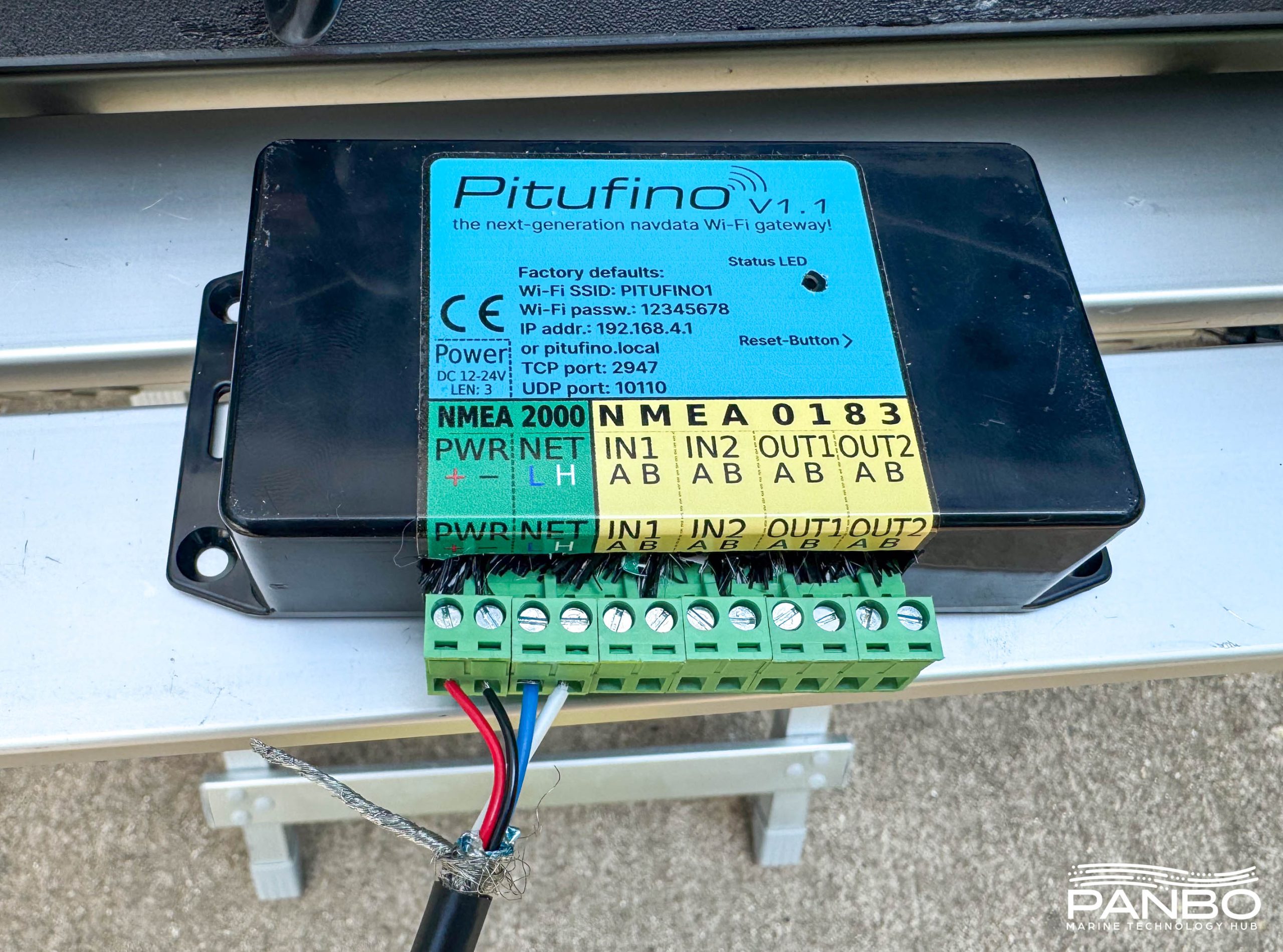
Category: PC & peripheral
Products developed by active cruisers grab my attention. In my experience, products created onboard solve needs and fix issues directly experienced by the creator. Pitufino is no exception. There is no shortage of NMEA 2000 to WiFi gateways in the marketplace. There are also quite a few NMEA 0183 gateways. But few of them are nearly as ambitious, flexible, or offer as many features as the Pitufino gateway.
In this episode, I sat down with Kees Verruijt of CanBoat and SignalK fame, proud owner of Merrimac (Profiled by Ben E.), and a Panbo contributor. The open-source boating software community owes Kees a...
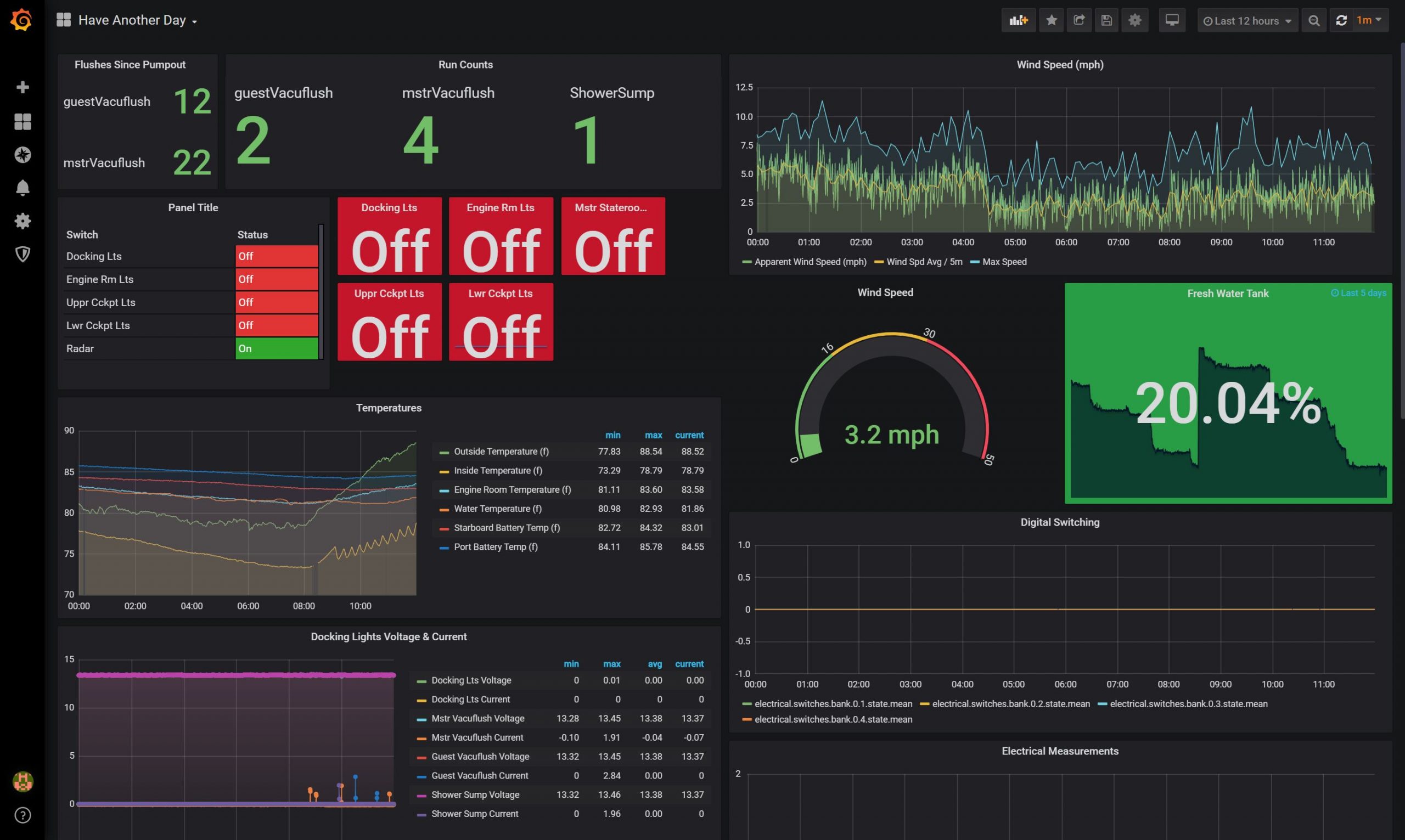
I have been wanting to explore more about what’s possible with Signal K server, and quarantine 2020 gave me the time. I’ve spent the last week or so exploring all that the server and its array of plugins make possible. I’m impressed and the dashboard you see above is just the tip of the iceberg of what I’ve been able to do with it so far. If you stick with me and some geeky talk I’ll tell you about what I’ve been able to do with all the data on my boat and the tools Signal K Server offers.
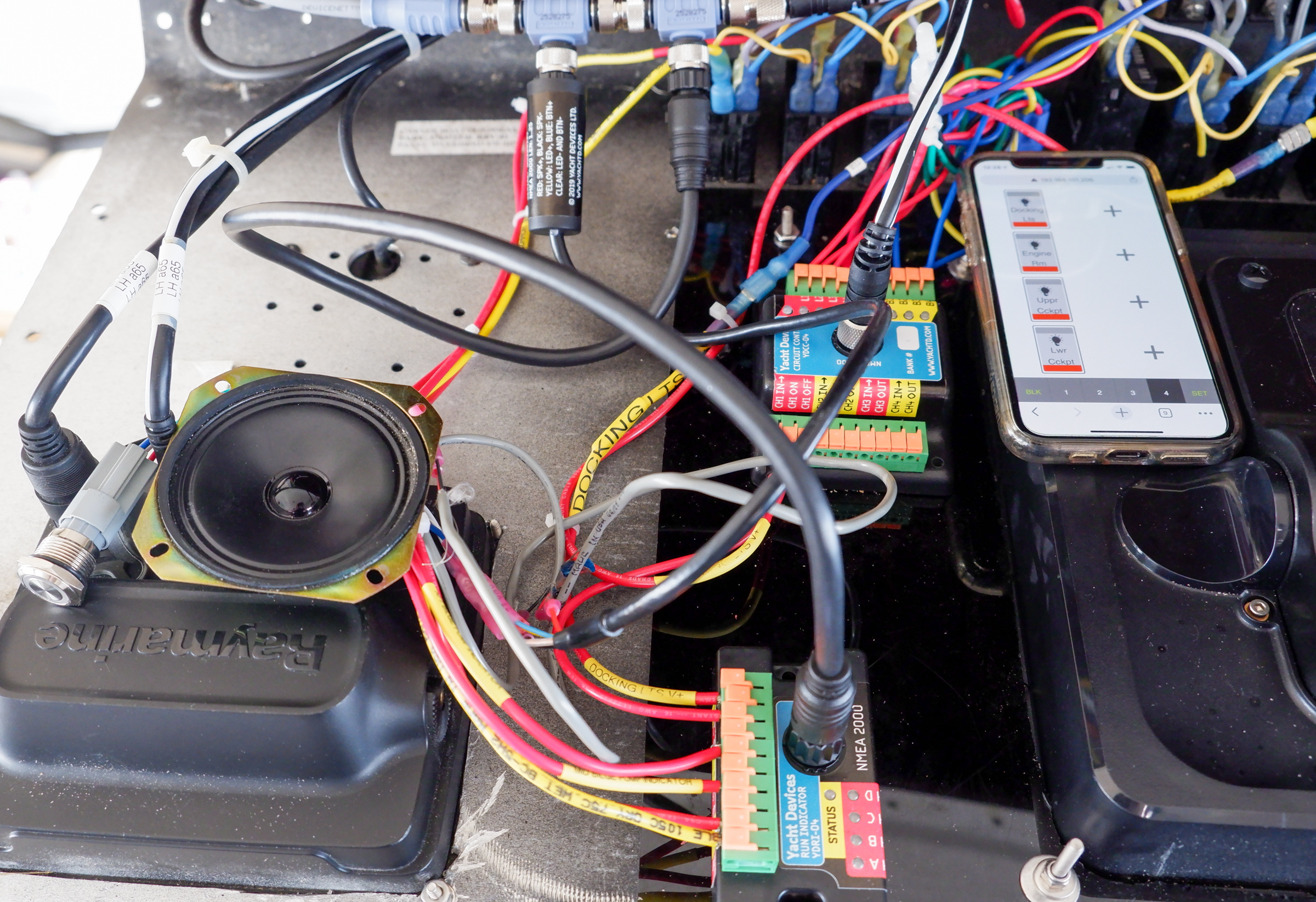
Yacht Devices Limited builds an impressive array of clever devices that solve specific needs aboard your vessel. Recently they’ve introduced a NMEA 2000 run indicator to monitor circuits aboard your boat and an alarm module that can notify you of problems or provide a man overboard button. These new products build on their impressive array of capabilities and make monitoring your boat easier and more powerful.
While walking the floor of the Miami International Boat Show something caught my eye in Si-Tex / Koden’s booth. I saw what looked like a PC screen running Coastal Explorer but with a radar display shown. It turns out this is a new version of Koden’s RADARpc that interfaces nearly any Koden or Si-Tex radar with a PC running Coastal Explorer.
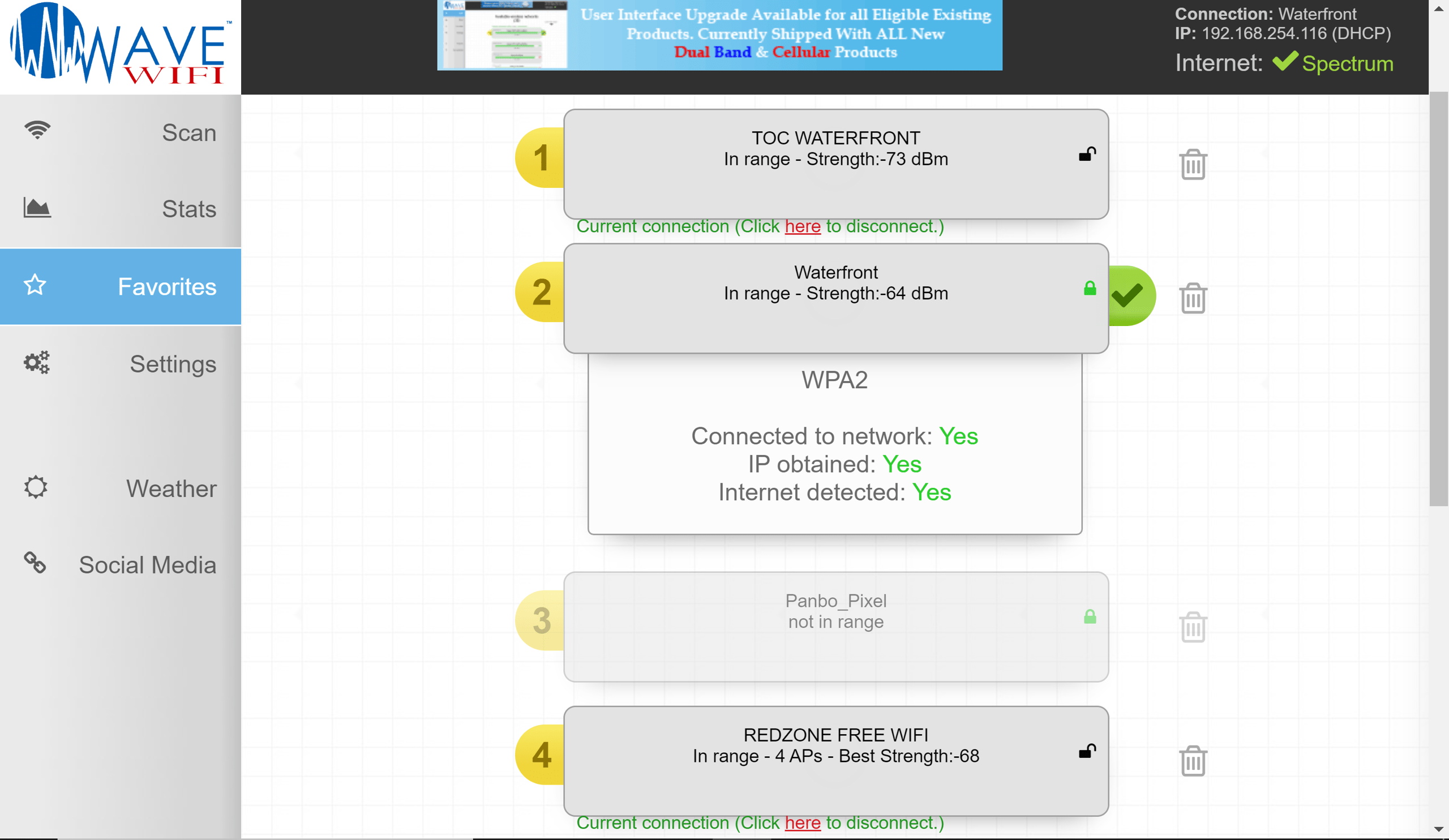
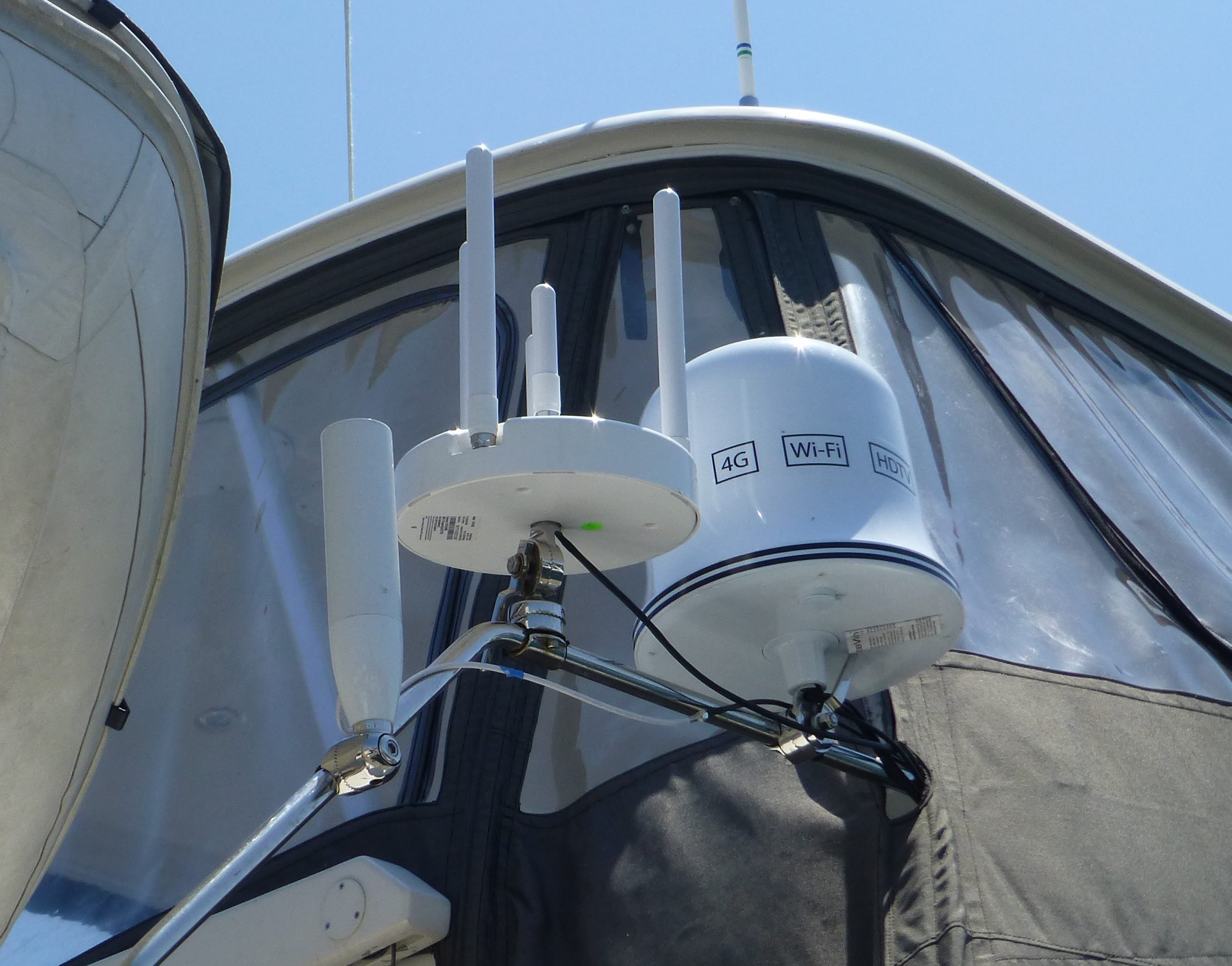
These days many coastwise cruisers rely on cellular for their internet needs, but there’s still a place for high power WiFi radios that can connect to harbor hotspots, at least on my boat. And Wave WiFi’s dual-band Rogue Reach model has been making me very happy in this department. The interface shown in part above makes it easy to find and stay locked onto even fairly distant access points, and often they’re in the 5GHz band that most marine WiFi systems can’t see…
My family and I have been back living and traveling aboard Have Another Day for about nine months now. Our boat is a huge consumer of bandwidth so I’ve learned a lot about what works and what doesn’t. Here’s an update and some tips on what we’re doing to maintain reliable connectivity.
There are a lot of WiFi bridges that can connect your boat to the Internet, though as I mentioned in my article on marine internet, depending on WiFi for connectivity while travelling can be hit and miss. But, without a WiFi bridge the chances of a usable connection decline dramatically…
Industry leading online chart service fugawi.com, announced today that in collaboration with world-renowned OpenCPN, it has made its extensive selection of downloadable raster charts available to OpenCPN software enthusiasts worldwide…
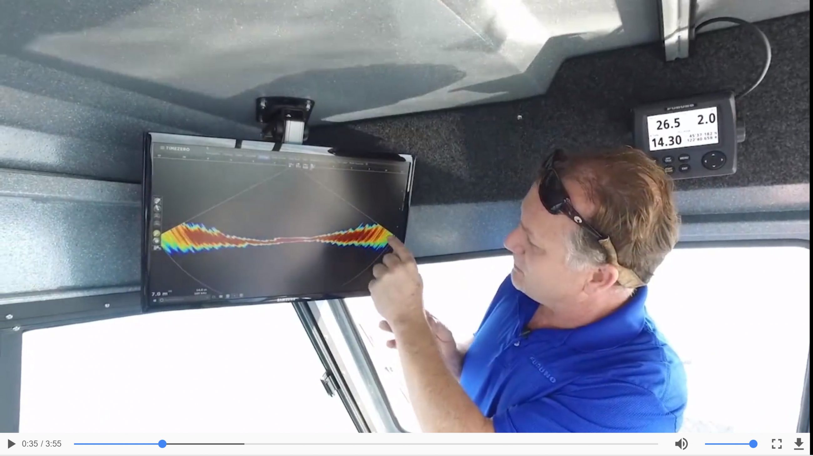
Available since November 2017, the Furuno DFF3D multi-beam sonar and the latest version of TZ Professional offer both commercial and sports fishermen a revolutionary bathymetry technology…


Recent Panbo Comments