
Android marine apps: Memory-Map is in, who else?
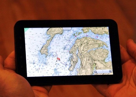
It’s still in public Beta, but Memory-Map has an Android version of its charting app. I’ve tested it with both my Verizon Incredible phone and also with the 7-inch Galaxy Tab seen above, thanks to a loan from Memory-Map developer Richard Stephens, who I profiled way back in 2005. Even then Stephens was writing good PC and PDA charting software, and the experience shows…
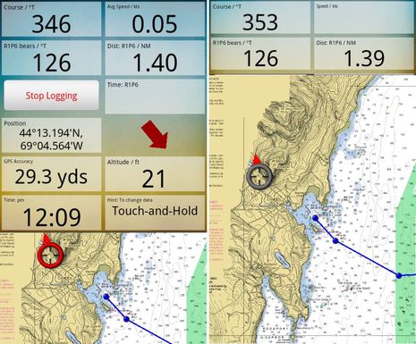
At this point there are a lot of good charting apps that display NOAA raster charts, but I don’t think any show them quite as quite as well or zoom/pan them quite as quickly as Memory-Map. In this Android edition, Stephens has also come up with a nifty way of managing data windows. As I tried to illustrate in the two screens below, the windows work like a shade that you can roll up and down with your finger tip. So you just select the data in order of importance and adjust the shade as needed…
Frankly, though, ever since I bought an iPad it’s been my preferred mobile charting device. So I was very curious to try my first Android tablet, and I’ll concur with Stephens that the Samsung Galaxy Tab 7-incher is a nice size, big enough to navigate on but small enough to wear around your neck in a waterproof case (like he does when racing, I suspect). Just click on the screens above and below to see the pixel count difference. But I did not cozy up to its extra wide aspect ratio. Maybe it’s just that I’m used to the iPad’s 4:3 ratio or maybe it has something to do with the Golden Ratio that mad Installer Ranted so delightfully about this weekend…
The screen above also shows the neat way Memory-Map handles waypoints in all its app editions (Android, iOS and Win Mobile 7 coming). The cursor button lets you move the point while still seeing exactly where it’s going to land while the arrow button leads you to a full menu of functions, like Edit, GoTo, Activate Route, etc. Nice! NOAA charting on Memory-Map is also free; you pay to get integration with the able PC version and/or to buy other charts, certain topo maps, or guide books.
Navionics, EarthNC, and Nutiteq are also doing good charting work on Android. In fact, I’m having a hard time keeping up with all the boating apps, and that’s partly why I’m writing this entry. Panbo has soft launched a new Panbo Classifieds section and one of its goals is to showcase the work of marine app developers. I hope to generate a little extra Panbo income from it eventually but right now long-term ads are completely free and I hope developers will flock there. (Basic ads for manufacturers, installers, etc. — and for used marine electronics, too — are also free so, please, everyone get involved!)
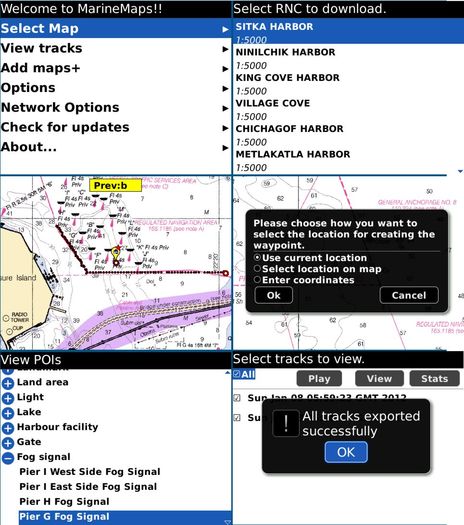
Incidentally, I think Android tablets will get some traction this year; I also recently tried a Toshiba Thrive 10.1-inch and liked it lot. But this app thing is going everywhere. Below, for instance, is a screen collage from what may be the first Blackberry marine charting app, GPS Nautical Charts. It too, like anything related to marine electronics, is welcome on Panbo Classifieds.


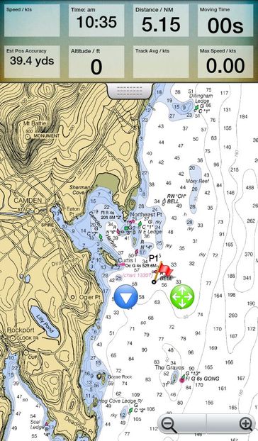
You could add MXMariner to the Android list. It’s pretty new – very inexpensive – and out now. As documented on their site, we’re working with them on ActiveCaptain integration for a future release.
What’s very interesting about MXMariner is the open source nature of the code behind it. From my understanding, there’s a lot of open planning with the display engine code. That could easily spark a lot of other developers adding overlays and other functionality on top of charts. The code to create the charts is already open allowing anyone to convert chart data to MXMariner’s format (even on the fly possibly).
Right! I had trouble downloading a chart region but it worked today when I wasn’t looking. And it does a nice job quilting charts, a feature Memory-Map lacks. Site here:
http://mxmariner.com/
Looks promising. Any thoughts on this app vs Navionics, or more generally, raster vs vector on a phone?
Panasonic has a couple of Toughpad Tablets in the works,shown at CES.
IP65, GPS and matte finish daylight viewable screen:
http://www.engadget.com/2011/11/07/panasonic-toughpad-a1-and-b1-the-tablets-you-can-drop-and-pick/
http://www.engadget.com/2012/01/09/hands-on-with-panasonics-toughpad-tablet/
http://www.panasonic.com/business/toughpad/us/secure-tablet-specs.asp#
And, as one might expect, there is also the Golden Ratio App for the iPad:
http://itunes.apple.com/us/app/golden-ratio-for-ipad/id409819609?mt=8
Android tablets allow access to data from Bluetooth serial (RFCOMM) devices, including NMEA Bluetooth bridges. I believe this cannot be done with unmodified iPads. This does offer advantages in some cases.
Re: Bluetooth GPS…
It’s true that it’s easy to connect to a Bluetooth GPS on Android. But…for offboard use, nothing beats a built-in GPS. I way prefer my Xoom because of that. For onboard use, I think that NMEA2K-over-WiFi will eliminate Bluetooth use on boats. It’s better and easily provides the full set of instrument data while onboard. Both Android or iOS excel at network/WiFi connectivity.
If the connected Bluetooth device is a only GPS, then I agree there’s no benefit compared to a built in GPS. I use a Miniplex-BT to send all NMEA (1083) data from B&G, Sailcomp and Garmin to either my Blackberry or my Xoom via Bluetooth.
I suspect that the BT constraints of the iPad & co will result in wireless extraction of NMEA2K data being limited to WiFi and not BT. Obviously from a technical perspective both could work. BT can have slightly lower power requirements than WiFi, and when the motor’s off small differences can matter. Otherwise, I don’t see an intrinsic advantage of one wireless technology over the other.
Somewhere in the numerous Android blogs and Forums I read that Android Apps now top iApps.
Jeff: I got 4.0 (Ice Cream Sandwich) for the Xoom last week. It’s a delight. Now that I can read a write to the finger-nail-sized SD cards, I can store routes and waypoints too. But I don’t think we’ll see an app any time soon that will read them…
Another Raster app for Android that I’ve been using for a few months now both on the 7″ and the Xoom, is Marine Navigator/Lite from German guy Ronald Koenig. It seems quite similar to MXMariner, except that unfortunately it doesnt quilt, you load BSB3’s singly, but worth a look nonetheless and its free.
https://market.android.com/details?id=de.kemiro.marinenavigator&hl=en
Cheers
Steve
Sandy Ive got 3.2 on my Xoom. I found the new Zoom to fit screen thingy a real bonus, Is it worth the upg to ICS what will I get that 3.2 doesnt give me?
Steve
The Memory-Map app has been pulled from the app store because it violates the developer agreement. Here’s the post from the memory-map support page:
Unfortunately, Apple don’t like our app and have removed it from the AppStore pending some amendments.
As such we are scrambling to release a version that doesn’t have access to the Digital Map Shop (In the same way the Kindle app cannot access the Kindle book store) and apologise for any inconvenience this has caused.
Steve: I really haven’t seen any problem with ICS.
Have you seen a way to ditch the “Pay-me-more” (rhymes with pretty-poor) apps from verizon?
The iOS version of Memory-Map is now back in the Apple app store. It is at a new price of $6.99. It is true that Apple have forced us to remove the ability to browse and buy premium maps and charts, but the free NOAA charts are there. Our marine charts for UK, NZ, Australia can be purchased on a PC and transfered to the iOS device, and so can third party charts in BSB format.
The comment above by “Anonymous” was from me. Sorry I forgot to sign in. Richard.
Hi Sandy, I wondered if you have had any problems with your Xoom on 3.2 handling HTML5, as I seem to, and if it cleared up on ICS.?
http://www.visitmyharbour.com
has just introduced HTML5 charts for Ipads, and although there are a few teething troubles with Zoomify, it works pretty OK…except on my Xoom. I’ve got a couple of “hundred quid” cheapie chinese tabs a 7″ and a 10″ and the HTML5 is working fine on those, but not on the Xoom, which I have to use flash on. Would appreciate anyone with another perspective could check this out and let me know if the problem on the Xoom is general with HTML5.
Cheers
Steve
No joy with HTML5 on ICS, but I hear that the Chrome for Android Beta does it peachy keen. See
http://www.sencha.com/blog/html5-scorecard-chrome-mobile-beta/
Hi Sandy,
Thanks for the heads-up on Chrome, although it will only run on ICS. Dont think the official ICS upg has rolled out as far as me yet, although it is underway.
I’m seriously considering Randall Rushing’s Team EOS ICS upgrade: http://forum.xda-developers.com/showthread.php?t=1484770
I will have to pluck up the courage to go for it, but it’s very stable and does stuff with the OTG port that the official version doesnt, and they are working on a kernel build that will allow an external modem from the USB port. As far as VZ is concerned you have my sympathy, it’s all part of the Vodafone Group, but in the US they seem to get away with charging for stuff that they cant in Europe, like Wi-Fi Hotspots which are free here. If it’s on the phone/tab it’s yours not theirs. Your data is very expensive compared to ours. A standard contract tariff here would be about $25 PM with loads of free calls and texts and “all you can eat” data. A modem data bundle is £15 for 3GB over a month, but you can get 15GB for £25.99 PM on a 24 month contract. The EU is responsible for all this, by bringing down and capping MTR levels, ie what the carriers charge each other for entry to their networks. So short of moving to the UK, or getting the FCC to clean up the US mobile industry, no real suggestions I’m afraid.
One annoying thing on the Xoom Speaker Dock, it doesnt have a USB feedthrough, only an HDMI, so once mounted it has to be bluetooth KB and Mouse only which is a pain.
Kindest Regards
Steve
Take a look at MX Mariner – http://mxmariner.com/ – it’s only $7 in the Android market, and while pretty new, it’s already shaping up to be a great app. Like OpenCPN, it’s under active, iterative development, with new features coming every few months.
This works great on both my Android phone and 7″ tablet. It’ll be getting some blue water use by me very soon.
I’ve found that most apps don’t actually understand how these apps are used, and require an active data connection, or you have to download individual BSBs/tiles in advance. Some don’t even support chart quilting. With MX Mariner, you download a region in advance – it’s a big file, for sure – but all navigation in that region is seamless (and switching regions is painless).
I’m really looking forward to where MX Mariner goes next, and looking forward to some of the other features coming soon, such as GPX import/export so I can interface it to OpenCPN.
I have no interest in MX Mariner other than being a happy user, and supporter of transparently developed projects.
Install MX Mariner from https://play.google.com/store/apps/details?id=mx.mariner
It’s interesting to see ActiveCaptain behind an open project for a change and realizing that openness is the way to go. Congratulations for coming around on that Jeffrey!
I had trouble downloading charts in MX Mariner when I had it on a Droid Incredible and I’m having it again on Galaxy Nexus. I’m on my fourth try for 258MB New England Region, and this phone has a good WiFi connection.
Ben,
I’ve had a few reports of this from people this week. The server has also definitely been getting slammed this week. And, I will be adding resumable downloads shortly. In the mean time, don’t hesitate to email me with any questions or comments. My email address is on the about screen in MX Mariner. I try to respond to each one.
Thanks,
Will
I can also recommend the open source OruxMaps which through it´s .kap conversion program OruxDesktop lets users install their own .kap charts.
It can also import optimized Tracks from the route optimizing program qtVlm using grib´s and boat polar informationin in .kml format.
Sinbad7