
ComNav Class A AIS transponder, with NMEA 2000!
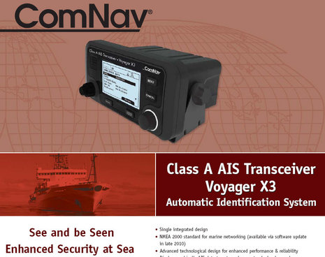
Very cool! It looks like the compact and relatively inexpensive Class A AIS Transponder that SRT teased last summer is not only getting close to real, but that it will also — nice surprise — have NMEA 2000 output (in addition to regular NMEA 0183 HS and RS232 PC outputs). The ComNav data sheet is available here (thanks, Dave!), but there are some caveats…
For one, the Voyager X3, as ComNav is calling it, is not yet FCC approved and therefore it’s not yet for sale in the U.S. And the price is not listed (I’ve asked), so we don’t yet know if ComNav met SRT’s hoped for “less than $2,000 retail.” Plus, the N2K output won’t come until a software upgrade is issued in “late 2010.”
But given all those caveats, this sure looks like an interesting new option in AIS. At 8″W x 4.2″ H x 5.4″ D, the Voyager X3 is sort of similar to the neat Simrad AI-50, only with the ability to transmit at 12 watts instead of 2. A yacht carrying a compact Class A transponder like this will get seen a lot further away, and will also be able to input its navigation state and destination, just like the big boys. And whereas we know that SRT actually builds these for OEM clients, we can probably expect to see it under other brand names soon.
And what about SRT’s promise for a small, inexpensive AIS receiver printed circuit board? Well, I have no idea if Standard Horizon is using one in its new GX radio combos, but I’m pretty sure there’s one inside Digital Yacht’s new ANT200 seen below. Yup, that’s a complete true dual channel receiver just 4 inches in diameter, and it only costs $300 with it’s own stubby VHF antenna. Digital Yacht’s got another interesting AIS receiver product I’ll detail soon, and it sure looks like SRT is making good on its promises.


I’ve learned from ComNav that the expected MSRP for the Voyager X3 will be $2,999. So maybe I spoke too soon about SRT’s promises coming true. In fact, you can already buy an ACR Nauticast2 Class A transponder for $2,999:
http://www.milltechmarine.com/ACR-Nauticast2-Class-A-AIS-Transponder_p_134.html
Then again, the price of SRT’s original, and perfectly good, OEM Class B transponder has fallen nicely over time:
http://bit.ly/74Wtcs
Ben: If we see retail discounts of ~20% on Comnav like we do on Furuno than $3,000 is still a pretty good starting price, about one third lower than the Furuno FA150.
But the Comnav is actually an inch *wider* than the Furuno and the “late 2010” date for N2K is ridiculous. Why bother, since anyone who wants one now will have to use 0183 directly (as there are no 0183-2000 bridges that support AIS at the moment)? I doubt that many who run 0183 wires now will pull them when the N2K firmware revision is released. (Though I guess maybe I would!)
But I do think the idea of putting N2K on a piece of “professional” gear is interesting, in that it acknowledges that recreational boaters are growing unhappy with the prospects (real or imagined) of second-class-citizen treatment of Class B AIS users.
/afb
Adam, The Furuno FA150 is actually a two piece system, with the black box FA1501 AIS transponder much larger than the FA1502 Monitor. That’s not really clear on the web page, but it’s illustrated in the install manual:
http://bit.ly/586mnd
And an interesting link regarding SRT and expanding Class A mandates:
http://teleq.blogspot.com/2009/12/software-radio-technology-first-orders.html
I think “transponder” is a misnomer for AIS equipment. The term was coined in Aviation for a radio that transmits a response when interrogated by radio from a ground based radar site. AIS does not wait for someone to ask it where it is, it just transmits and receives continuously. For that reason, I hold that “Transciever” is the proper term, and notice that most manufacturers seem to agree. Vendors are more sensitive to the language that customers might search for, and tend to use both terms in their literature.
We’ve been around this tree before, Sandy. I think you’re right that AIS doesn’t quite meet the definition of transponder because it’s automatic. On the other hand, the time organizing scheme is interactive. Plus transceiver, while completely true, is too general.
At any rate, the USCG and other authorities use transponder, and that’s good enough for me…
http://www.navcen.uscg.gov/enav/ais/
I called ComNaV today to verify that this update has happened. Not yet…
Is there such a thing as a Class A AIS that is NMEA 2000 capable?
Howard –
Take a look at the McMurdo Smartfind M5, a Class A AIS that uses NMEA 2000. See:
http://www.mcmurdomarine.com/ais-electronics/100-smartfind-m5-ais-class-a-transponder
Unfortunately, it’s not inexpensive (it retails for approximately $2,200 in Europe) and I don’t know if it is for sale in the United States.
Thanks Dan for the Link! It doesn’t appear to be FCC approved..
I do see the McMurdo Class A AIS displayed at U.S. boat shows, so I think it’s approved. The approval may be under AMEC, which actually manufacturers it.
Howard, ComNav told you that their Class A doesn’t yet support NMEA 2000? That would be darn surprising as it’s actually made by SRT which has numerous N2K AIS devices.
https://panbo.com/archives/2011/06/srts_2011_oem_ais_products_a_boat_load_.html
Yes Ben, I called ComNav directly and was told that it does NOT support NMEA2000.
I will search for the Amec, it is not under Mcmurdo or their parent company.
Milltech also sells the AMEC Class A in the U.S., and lists it with NMEA 2000 output:
http://www.milltechmarine.com/AMEC-CAMINO-701-Class-A-AIS-Transponder_p_267.html
But I also found further confirmation that the SRT-made Class A sold under ComNav, Em-Trak and other brands never got working N2K output:
http://www.westmarine.com/buy/em-trak-marine-electronics–a100-ais-class-a-transceiver–12333944
I have sent an email inquiry to Milltech. They are local to me. I am hoping they have put one in place or are willing to let me test it on a NMEA 2000 network. I have the rest of the week off to spend on boat projects.
I am interested in using a class A on a “pleasureboat” since I have seen how much reduced the range of class B transceivers is compared to class A even giving fault-free masttop antenna installations. Class B does not in my experience give more than 12nm while there seems to be almost no limit with class A. I have myself seen nearly 100nm on rare occasions.
I don’t like the added power draw, though, and my main questions are:
– do I violate a law and can expect negative consequences if I fail to update the voyage-related data when I am supposed to or if I set this information to blank (if that is possible)?
– does a unit such as the AMEC take heading data from NMEA2000 or do I need to provide this via the separate sensor ports shown in the wiring diagram using NMEA0183? An will the unit work correctly when no heading data is available? (I think so because I have seen class A targets displayed perpendicular to a pier)
I cannot find anything that would preclude a recreational boat to utilize a class A.
The power is a little more, but 12nm is pretty darn far. Even at 25knot cruise, that is is still a 1/2 hour of avoidance time.
The main reason I am interested in the Class A is for the rapid position update. We cruise at 24-28knots. Class B only updates every 30 seconds. I have seen some conflicting info on that though.
I received an email back about the AMECO 701. I asked your exact question and then some. The response was less than convincing. It basically said “sure does, says it right there in the manual”. I was hoping for first hand experience. I don’t want to be a trial user. This model is not sold by nearly as many OEMs as the SRT Class A. The ComNav is the least expensive of that version and with the NMEA 2000 AIS adapter from acti sense, it still adds up to less money. Especially since the AMECO distributor is local and I would end up paying 9.5% sales tax on top of the $2500 purchase price.
This is the response I received from the importer. They communicated with the manufacturer in Taiwan.
“Camino-701 can only receive inputs from NMEA0183 and any NMEA0183 message supported by Camino-701 can be output through NMEA2000. So Howard should not have issue connecting through NMEA2000.”
Hope this gives you what you need.
Not a very clear response, but it looks like the NMEA2000 is only output.
I have a variety of ways of addressing this.. I am just looking to do a clean install of NMEA 2000 install. At this point it has just been a pursuit to find something for the sake of the pursuit.
My interest in Class A is solely because of the rapid position update. I cruise at 25 – 30 Knots.
I have an Airmar GH2183 for my GPS/Heading sensor. I can either purchase the special Airmar cable that has both 0183 and 2000 pigtails or purchase the Actisense NMEA 0183 AIS converter.
Nothing has been simple with the Furuno TZ touch system.. but I really like it. Not understanding the bits/pieces needed to get things done. (Separate power supply for the radar, heading sensor needed for radar overlay, etc)
Howard: thank you for taking the trouble of asking AMEC.
Yes, I also don’t like the slow update rate of Class B.
I agree, most of the time 12nm is more than enough. But most of the time leaves some of the time when it isn’t enough. For me this is on passage in the open ocean with big ships crossing my course when I have wished they could see me sooner. With a container ship steaming at 18 knots and us moving at 6 we are closing in at up to 24 knots, meaning 12nm is no more than a half hour. I cannot expect them to change course the instant they see me. If I give them 10 minutes to take action, then we are down to 20 minutes to CPA which I will spend with my eyes glued to the screen.
If they could see me reliably at 48nm = 2 hours and I could have seen them change course 1 hour or 45 minutes to CPA, that would have made a passing just that much more comfortable for me a few times.
About heading input: I have an Airmar H2183, which like yours can additionally provide NMEA0183 heading but this would mean to run another cable through the boat and one more channel to develop a problem (which would be hard to detect and to troubleshoot). And if you use a NGW-1 for heading input than you might as well use the other channel of the NGW-1 for AIS output. So the ComNav may be the better choice after all.
About the requirement to update voyage-related data on a pleasureboat (and also the requirement to run it all the time): After googling and browsing through legalese for a while I have understood that I am not likely to find a law explicitly allowing this but rather that there does not seem to a be a law explicitly disallowing it – which in effect could be the same thing. If I am not required to operate class A AIS then (this is my understanding) I am also not required to run it all the time or update voyage data whenever I go out for an afternoon of sailing if I chose to install class A. Nowhere did I find a sentence saying “if you chose to have it even though there is no requirement to have it then you have to operate it to the same requirements in effect for those that have to have it.”
So I will seriously consider it and the ComNav seems like a good solution.
Ok, I know I am beating a dead horse, but I am going to explore a bit more.
I found a Furuno Class A AIS FA-150 with antennas AND a Furuno GP-32 GPS receiver for a total of $250.00 A reputable yacht outfitter is selling them. I was able to get the password for the AIS so that I can change the ships static data (MMSI most important!)
I am hoping that there is an optional board installed in the AIS called a NET 100 board by Furuno. It is a LAN connection for the NAVNET network. If not I will have to purchase that board at a retail of $425.00 There are no manuals/specifications online for the LAN board, but I am hoping that it shares all of the AIS data over the network. We will see!
I haven’t received a response to this question on either the THT or Furuno’s own support forum. This appears to be one the black arts/Furuno keeping the info close to the dealer’s technicians chests.
I finally am on the the air broadcasting a Class A AIS signal.
I installed a Furuno FA-150 AIS system, Furuno GP-32, Furuno PG500R, and a Furuno IF NMEA2K2 converter to make it all work.
The install involved a lot of reading, a bunch of questions on the Furuno support forum, a few local experts and a lot of cables and itty bitty terminations.
I very rewarding project that hopefully raises are situational awareness and lets others know where we are.
Full pictures are here
http://www.thehulltruth.com/marine-electronics-forum/633257-progress-electronics-upgrade.html#post7291959
http://www.thehulltruth.com/attachments/marine-electronics-forum/475927d1416118243-progress-electronics-upgrade-photo-3-3-.jpg
Yes it is mounted upside down, much easier to route cables.
Henning,
in response to your above conclusions about AIS A-
AIS A is an automatic identifier- not collision avoidance. to anticipate altering course because of the information is foolhardy to say the least. What it will do is id the plot onto the other vessel radar where you may be located. when close enough to the vessel that the radar has a return image- then the rules of the road come into play. most likely at 20 plus knots the ship will not alter course as your target speed will not require much to get you by- and the most any vessel will give you is a CPA of two miles- if they are able.
The misnomer to treat AIS as a collision avoidance is a public recreational lack of understanding the equipment and technology.
Additionally-AIS B units transmit when available slots (polite technology) but that does not preclude them from receiving the AIS info. The single three killers of AIS B- long coax runs to the antenna and incorrect antenna (stubby or non-tuned to the higher AIS frequency),low antenna (they need to be 3 meters from the water surface in unobstructed view) and the populary sold splitter for masthead VHF antenna.
Second- the recreational vessel is not required to carry AIS A or B, but when carried, it is expected to be operated correctly. That means you may turn it on and off (transmit when you desire) but if transmitting then it is expected to be used correctly.. Should it be incorrect sending of data, you may get a visit from authorities if an incident occurs and or they are using it with homeland security. particularly in the north east us coastline. the precedent set was the Point Judith oil spill ten+ years ago- not a required piece of equipment but if installed then expected to be used and maintained under proper seamanship. Again, risk is your choice- but if you spent the extra money on the equipment, then you are expected responsible and disciplined to maintain it.
Thanks, Ted, but it’s unfair to blame recreational boaters for considering AIS a collision avoidance tool when the U.S. Coast Guard states that “AIS is primarily and foremost a navigation tool for collision avoidance” — http://goo.gl/dshDNJ
I could cite many other authoritative sources that term AIS a collision avoidance tool, but I believe you’re basing your argument on an IMO document that was written at the very beginning of AIS. Here’s an article about how those guidelines have perhaps been misunderstood:
http://www.hellenicshippingnews.com/c7a07de8-3a3f-4688-855c-ce918b407e1a/
And here’s where anyone can download the IMO guidelines:
http://www.navcen.uscg.gov/pdf/AIS/IMO_A_917(22)_AIS_OPS_Guidelines.pdf
Please note sections 39 & 40:
“39 The potential of AIS as an anti-collision device is recognized and AIS may be recommended as such a device in due time.
40 Nevertheless, AIS information may be used to assist in collision avoidance decision-
making…”
A lot of us, including ships, are using AIS to assist in collision avoidance decision-making, as permitted by the IMO even when few bridge crews had real experience with it.
Interestingly, the IMO will purportedly issue new AIS Guidelines soon, and I’ll bet they’re less cautionary about its usefulness.
Ted, I know from our phone call that you are passionate about AIS issues like this and antenna splitters, but I’m hoping that you can hold off a little until I write a dedicated entry on these subjects.
I know that AIS is not to be relied on for primary collision avoidance, it is just another tool. Eyes out the windows are the primary tools. Radar, ears out for horns, etc are other tools. Staying out of the VTS lanes in the Puget Sound is another method.
Class A would have been undoable if was not for finding the system used.
I am confident in the data we are transmitting, it can always be cross referenced as we have three sources of GPS and three sources of heading if you include the helm compass. The antenna system was swept for faults, the power output and reflected were measured, the coax is LMR-195 and the antenna is Morad tuned for AIS antenna.
After installing the Class A, I would NOT recommend it for the casual user. The install was NOT plug and play. I am only have experience with the Furuno, but having to add another heading sensor to get the AD-10 format, having to add secondary 0183 source of GPS and being lucky enough to have a Furuno dealer give me the password so that I could change the ships static information as well as multiple trial and error changes of the comm port settings (there are SIX comm ports)
Furuno is rumored to be revamping their AIS systems. They do not offer a “Blue Force” encrypted AIS system.
If someone could legally produce a product that utilizes the communication protocol of Class A, with the data input requirements of Class B, I think that would be a great safety tool.
This was a learning exercise, a project with my kids and hopefully a good safety tool.
As far as I can understand, NMEA 2000/Canbus has the bandwith and speed to support Class A AIS. It would take a lot of traffic to exceed its limits. The Furuno system does have the option of an Ethernet connection. I could not find ANYONE who has installed the LAN card. I did verify that it only outputs the AIS data and wouldn’t input the nav data from the NMEA2000 network/chart plotter.
Anyways, I have taken up a lot of Ben’s Panbo bandwith with my project… I have not ventured out yet with the system, we are sitting at the dock broadcasting.
Here we are on VesselFinder
http://www.vesselfinder.com/vessels/DOUBLE-TROUBLE-IMO-0-MMSI-367610090
Hopefully we show up on https://www.marinetraffic.com/en/ soon as its receive stations seem to be more complete.
Thanks Ben, and I am willing to answer any questions if there are any.
Howard
My pleasure, Howard! It’s been great how you documented your AIS goals and solutions here and elsewhere, and now we know that Class A NMEA 2000 is harder to get than expected (though N2K definitely has the bandwidth to handle all the AIS target info any transponder can generate plus the precision GPS and more).
At any rate I’m seeing Double Trouble now on Marine Traffic and they show position records back to 2014-11-12 23:47 UTC. For some reason your Vessel Detail’s page doesn’t seem to work but check this link:
http://www.marinetraffic.com/en/ais/home/_:d6eae79be759794707dcc7977980583c
Ben,
Good day,
the above note was not intended to discuss your research or the AIS issue as a single topic-but was an observation response to the above blog from Henning.
Specifically, the discussion of a recreational yacht(voluntary) needing to keep or maintain the AIS A correctly when using- the answer is if installed yes- they must . That is noted in USCG . it http://www.navcen.uscg.gov/?pageName=AISFAQ #6 has origins to the reason AIS B must be programmed by a licensed installer- AIS A has an expectation reliability of the transmitted data.
As far as considering it a collision avoidance tool as per the FAQ #5, that is a simplified description to discern the security side of AIS and Homeland security use vs ship to ship use. I agree it is there but caution it is used out of context.
As far as the IMO http://www.navcen.uscg.gov/pdf/AIS/IMO_A_917(22)_AIS_OPS_Guidelines.pdf#sthash.gdVVOji8.dpuf guidelines you quoted above-
39-and 40 suggest it may be used in conjunction with collision avoidance, but “41 The user should not rely on AIS as the sole information system, but should make use of
all safety-relevant information available.” must be added- as it shows that although the information is utilized do not use it as only method. It has serious limitations.Therefore the name Automatic Identification System. I am not sure IMO will define AIS less cautionary in the collision avoidance category because in the larger picture it is a part of navigational tools. Additionally, the proven documentation on record now of the errors of the system are since that document was crafted.
That is the issue that AIS B and our discussion for a later blog- the recreational user will economically purchase the AIS equipment and therefore forgo the expensive mysterious radar- and the result will be reliance and therefore expectation it is accurate- without as mentioned by http://www.hellenicshippingnews.com/c7a07de8-3a3f-4688-855c-ce918b407e1a/#sthash.gdVVOji8.dpuf the in-depth understanding and training.
I apologize for prematurely interrupting your research schedule, that was not intended. I do await that blog.
Ted
Ted, my question was:
Ships that are mandated to use Class A AIS must, AFAIK, operate it 100% of the time, including when they are stationary, tied up alongside.
If boats not mandated chose to carry AIS class A, do they then also have to operate it 100% of the time? Pleasure boats may, on average, get taken to sea 1-5% of the time. Do they have to operate their class A AIS the remaining 99% of the time, even in winter when they are on hard standing under shrink wrapping?
I did not mean to imply that non mandated class A users may not have to operate it correctly *when* it is operated (i.e. not providing correct heading input).
Regarding the use of radar: I own a leisure marine radar, Navico BR24 4G, mounted 13 feet above the water, and am very interested in learning to use it to it’s best potential. Even so, when crossing from the Azores to England, I could reliably see large container ships at only 2 to 4nm while I could see the same ships on AIS at up to 90nm. In the foggy, misty weather typical for this area, especially at night, and with the typical container ships closing in on me at 20+ knots, 2nm is far too little for comfort and in these situations I would not have traded my AIS transponder for anything and my use of it in this situation would most definitely have to be called “collision avoidance”.
My real world guestimate after having an email conversation with the USCG navigation Center AIS subject matter expert:
If I start I leave the dock with the AIS transponder on, it will be noticed if I turn it off while on the water. If I turn it off at the dock and leave the dock with it off, no one will notice/care.
Knowing that I am broadcasting A, and I will transiting around the Puget Sound VTS areas, a few naval bases in the area and moving at a far greater clip than most other AIS users (25-30knots+) I am expecting a visit, especially if I do something silly like turn it off around around an aircarft carrier.
I will have to very diligent about not anchoring in Canada or having lunch in Victoria etc without checking into customs.
Henning,
AIS is the greatest single communication device since the VHF radio. Your seeing vessels 90 miles is part of the atmospherics, but it is doing what you need- ID and situation awareness.
to answer your first clarification-no- when the vessel is not working you will, particularly a voluntary, not be required to operate the AIS. the intent of commercial vessels operating at dock, anchorage, etc. is that they are operating continuously. The AIS A permits security, other vessels, etc. to be aware of the presence of the vessel. The choice to leave it on in the marina is personal, yet in an anchorage, particularly a non-designated one with commercial traffic it is a prudent choice if equipped.
The use of AIS in your situation vs the shorter radar range-that is making proper use of all equipment. But be aware, as speeds increase in closing situations, the lag times and inaccuracy of AIS can create false security and decisions that should not be based on AIS alone. The radar now comes into play confirming the ais information.
I am aware a future blog will discuss these issues- I do not want to get into that yet.
My suggestion To make the most of your radar, and all navigation equipment, practice with it during calm and daylight conditions. It is mysterious for most users simply because they do not use the equipment until needed-and so fail to understand how to tune, where are the blind spots, what weather does to the signal. The AIS presents a pretty video plot with crisp lines-
Ted
Hi Henning,
I meant to note that something must be wrong with your 4G radar if you’re only seeing big steel ships at 2-4nm. Range has never been Broadband Radar’s strong suit but I’ve never seen or heard of performance that bad, especially from 4G. In fact, I had some surprisingly good experiences with 4G range during my recent trip Maine to North Carolina. I have a screenshot showing the bold coast of northern Massachusetts almost 34 miles away and I recall targeting a big sea buoy off the New Jersey coast at over 8 miles.