
Comar AIS-MULTI receiver, looks great but…
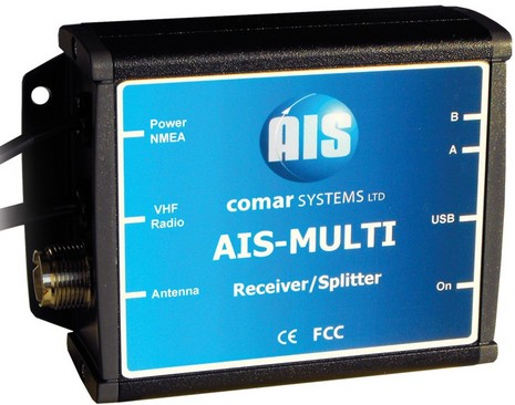
After METS 2007, I wrote about how many new AIS products Comar had in the pipeline. Well, this U.K. company hasn’t slowed down, and has even developed a snappy new logo and Web site. Comar’s latest is this AIS-Multi, which seems like quite an able AIS listener at $399 (from U.S. distributor Milltech Marine). It features true parallel receivers, so slow Class B updates will plot as well as they can; an amplified VHF splitter, so you don’t need to add another antenna; USB data output, so you can connect it to a modern PC without needing a serial converter; and, finally, the ability to multiplex in NMEA 0183 data at 4800 baud (GPS most likely), so the unit’s 38,400 baud data output can be easily used with a plotter whose NMEA 0183 port was already in use (and the PC will get it, too). But…
But, as reasonably priced and feature rich as this AIS receiver is, why not spend $330 more and actually become part of the Automatic Identification System with your own Class B transponder? I use that number because Milltech itself offers both the Comar CSB 200 and the ACR Nauticast-B for $729 each, with GPS and VHF antennas included. I’m not sure everyone realizes that these transponders will do everything a good AIS receiver does, and much more. As Milltech clearly puts it, a Class B “can also
be used as a dual-channel Class A /
Class B AIS receiver
and GPS receiver.
This allows you to
connect the unit to
computers and chart
plotters and use the
transponder’s GPS
and AIS information
from other nearby
vessels to display
your position and
other vessels on
AIS-capable
applications and
devices. In other
words, this device
can function as an
AIS Class B
transponder, a GPS
receiver and a dual
channel AIS receiver
– all at the same
time.”
Meanwhile, yours truly (when not fixing windows) has continued to check out Siitech.com and is seeing more Class B’s every day. I even saw one with screwed up name and dimension data, but that’s very rare, and this guy will still show as a target on most any AIS-equipped bridge within a 5-10 mile radius. Isn’t that worth $330 and an antenna install (with a backup GPS thrown in)?


One oddity I should note is that Class B transponders do not seem to deliver all the secondary GPS information that comes out of a standard GPS. I have not completely figured this out, but it looks like some plotters and charting programs will not accept the output as valid GPS positioning, and those that do can’t display a GPS status screen with individual satellite positions and signal strength. I’m trying to get to the bottom of this.
Ben have had the West Marine transponder for about a month now and although I screwed up the boat dimensions at first they reprogrammed it overnight and all is right now. It is setup with a Garmin 4212 and was doing a great job until I updated the Garmin software then the KVH compass went away and every target became a potential threat. Will figure it out soon. I will be in Camden with boat and would love to show it all to you then. Lord Nelson Victory Tug.
Allan Seymour
My ACR Class-B transponder only puts out satellite status messages when connected to the ACR “Link” software. It seems that the AIS-B is programmed to only emit these status messages in response to a query, and can’t be configured to otherwise emit them. I spoke with ACR tech support, who confirmed this and suggested to talk with the GPS/AIS module vendor — which I did, and got the same story. If you like, I can dig out the NMEA capture files I made when I was bench-testing the ACR unit.
It sure would be nice if these transponders could be more configurable, like the Garmin GPS pucks are, for example. I was told that they are trying to keep it simple and difficult to mis-configure, which I suppose makes some sense given the concerns about improperly set-up AIS equipment.
But, this meant that I had to install both the ACR and the Furuno (NN3D) GPS mushrooms on VALIS (my boat). I don’t mind the redundancy, but it shouldn’t be necessary.
Thanks, Paul. I will definitely write a follow up entry on this, but what I’m realizing is that the ACR and most other Class B transponders only include a limited subset of the GPS messages in the data they stream out to PCs and plotters. Some of those recognize it as valid position data, some don’t.
Interestingly, it turns out that the Comar CSB 200 can put out 8 different GPS messages, including satellite status, plus it’s control software includes the ability to filter those messages, in case your charting program or plotter can’t handle multiple GPS inputs. (I learned this thanks to Doug Miller at Milltech, who did some data detective work today.)
I don’t think it’s a bad thing that you have two GPS mushrooms, but either should be able to drive whatever plotting displays you have wired to them. Apparently that’s possible with Class B, but many manufacturers like ACR haven’t gotten it quite right, yet.
I can’t speak for PC nav apps, but MacENC for Mac and iNavX for iPhone/iPod can use either $GP GPS NMEA sentences or !AIVDO AIS NMEA sentences to navigate with. This is handy if one prefers to only interface an AIS transponder to a Mac and MacENC. The downside with AIS NMEA !AIVDO is the update frequency is not the typical 1 Hz of the $GP NMEA data, but more like 3 – 20 times a minute.
Ben I am using the Navionics NAIS300L NEMA2000 into a pair of Garmin chart plotters running 5.0 software. My KVH NEMA0183 heading sensor still works fine however it keeps alarming thinking my boat is it’s own target.
I am fairly fristrated neither manufacture has been able to help me. I am just north of Atlantic City (Tuckerton Creek, Little Egg Harbor) so you may have seen my signal show up on the internet based service you are using. At this point I am very frustrated.
Bill Lentz
Sounds like a bummer, Bill, but a short-lived one I hope. Given yours and Allan’s comments — and the fact you are each using different transponders over different data pipes — I’d guess that Garmin created an AIS alarm bug when it totally made over AIS functionality in the 5.0 software. I may be able to experiment with Garmin AIS myself this coming week, or maybe you and/or Allan can send screen shots or photos illustrating the problem.
There seems to be a NEW sw update from Garmin to fix the heading sensor conflict. It’s 5.2!
Change History
Changes made from version 5.10 to 5.20:
Fixed potential lockup when connected to NMEA 2000 Heading Source.
I am also installing my NAIS 300-L (N2K version) to a pair of Garmin 42XX plotters. These plotters came with the Garmin GPS 17x antenna which puts the GPS data on the NMEA 2000 bus.
I called Navico support today and found that the NAIS 300-L can’t read GPS information and I need to install a second mushroom (supplied). This sort of bummed me out, but maybe the guy was wrong.
Craig, by regulation every Class B transponder must have its own GPS antenna. Thus it will continue to transmit even if your whole Garmin system and/or N2K backbone craps out. (Also, some plotters, though not Garmin’s, and some PC charting programs can use that GPS output as an alternate, backup position source.)
But don’t think you have to go to a lot of trouble to install that GPS antenna. I have two Class B systems on my test boat right now with their GPS antenna pretty casually installed inside the balsa-cored fiberglass flying bridge helm, with 2-4 large MFDs and lots of other stuff a couple feet above them. They both work fine.
I believe that the definitive reason for the dedicated GPS is that an accurate timing signal is required to define the broadcast slots.
The timing signal is supplied by a PPS (Pulse per Second) output from the dedicated GPS devices. These signals are accurate to within 15 ns to 1 us (depending on model / chip set) of the start of the UTC second.
Most marine GPS units do not have a PPS output. The Garmin GPS 18x LVC (not a marine model) does have PPS output.
Jon
JonM:
The 1pps is only required by the Class A units, Class B takes its timing by listening to Class A’s or base stations (it’s a patent thing…..)
Ben’s explanation is closer to the truth, and when the Class B standard was being written, the GPS’s available on the market were going through a very rapid performance improvement phase, and by specifying an internal GPS module, the standards could ensure that only the newer and better GPS modules could be used. 5 years later on, and its virtually academic now, but at the time, it was a real concern.