
2 new Garmin VHFs, remote mic too

Even if it was predictable (I got it half right), Garmin is indeed adding fixed VHF radios to its ever-expanding marine line. Here’s the press release, and here’s…
![]()
The Marine Technology Hub

Even if it was predictable (I got it half right), Garmin is indeed adding fixed VHF radios to its ever-expanding marine line. Here’s the press release, and here’s…
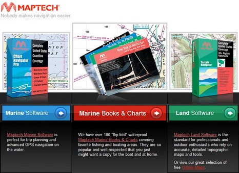
Above is the new home page at Maptech.com, and while it represents the end of the old Maptech, it sure doesn’t mark the end of the Maptech name. In fact, the blue “Marine Software” tab takes you to a new company called…
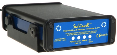
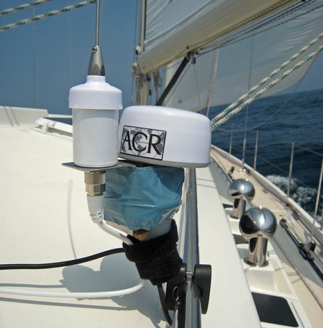
Shine Micro is not the only company offering a Class B workaround, i.e. a high-end AIS receiver that can later be turned easily into a full Class B transponder. The same is true of the SeaVieweR above…
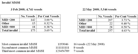
The above (bigger here) is clipped from an interesting report on MMSI “anomalies” that dropped into my e-mail box. It makes a good case for why the FCC decided that Class B AIS devices should have their MMSI numbers input in a controlled way, and…
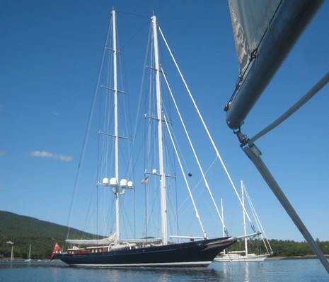
The 18′ Annie G. must have looked comical, not to mention bedraggled, circling the 169’ schooner Meteor as she varoomed…
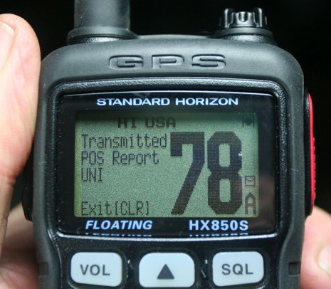
I finally got my hands on a Standard Horizon HX850S GPS/VHF, and I’m almost in love! Even if the 1.75” screen seen above…
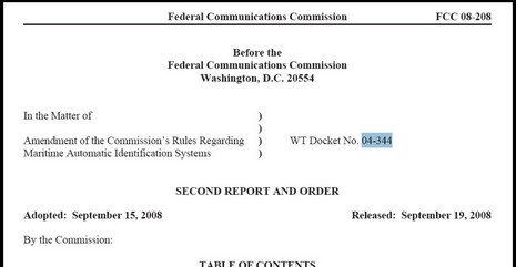
My Class B AIS sources were right! Though it’s not yet in the FCC Daily Digest (Monday, probably), the new AIS Order was released yesterday and is posted as a PDF. And it looks good…

Two days in the deadline mill and I’m tuckered. But I thought you might enjoy this rather gorgeous helm, bigger image here. It’s the custom Wesmac 50 I mentioned back in June, i.e. the boat on which I got a taste of my writing subject, Garmin’s new autopilot. So let’s forget about that for the time being and take a look at the ergonomics of this dazzling command and control center…
Today two reliable sources told me that all five FCC commissioners have now signed off on Class B AIS for US waters, though neither knows when the Order will become effective. The final step should be…
So how about a product whose details are mysterious and which may not exist, and even if it does, probably doesn’t work very well? The thing is that I’ve gotten a little Bluetooth happy, and the Deckband 4i concept looks like a particulary interesting way to use it on a boat…
 TZ iBoat 4 comes to Android with a redesigned navigation experience
 Never miss a word on the water with Garmin Signal VHF marine radios
 New AIT6000 AIS Transponder from Digital Yacht brings AIS to the space age
 Savvy Navvy launches waves feature empowering boaters to plan safer and more comfortable journeys
Recent Panbo Comments