Monthly Archive: September 2007
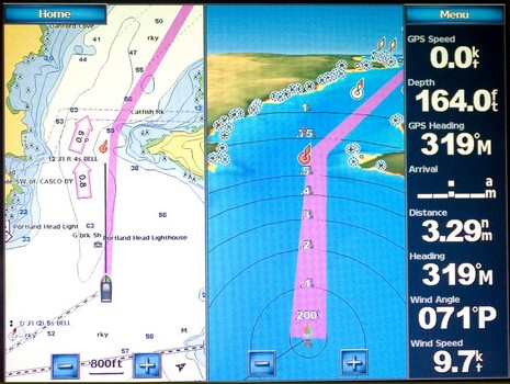
Here’s an entering Portland, Maine, screen photo, bigger here, designed to make a few points re: our discussions of the Garmin Guide To feature and the way the big units display data. This is a Combinations screen and…

As of today, MadMariner.com joins Power & Motoryacht and Sail as a Panbo sponsor. You may not be familiar with the site, as it’s nearly brand new, but it’s an ambitious operation putting up fresh, and mostly original, boating content every day…
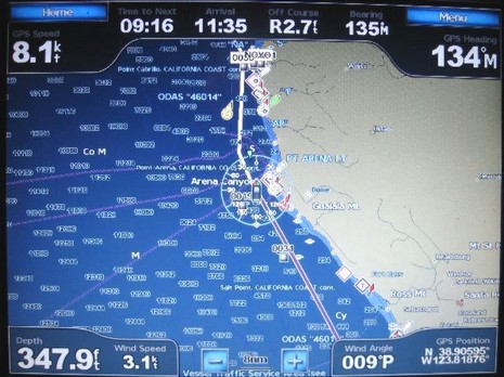
Last week I got a call from Phil, who’s cruising his Tayana 55 down the West Coast, headed for Mexico and beyond. He “loves” his new Garmin 5212, except for an interfacing bug that he’s hoping someone (Garmin?) can help with…
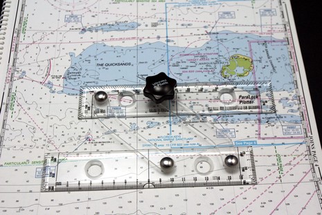
What’s this…a pair of parallel rules that didn’t eat right as a child? Nope, the 7.25” ParaLocks were especially bred for taking the lat/long of a waypoint off a paper chart. Put one edge on…
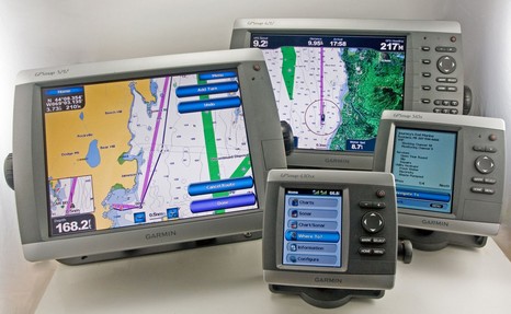
This photo, of which I’m especially proud (talk about herding cats!), is also a great example of how well Panbo can work with magazine articles. It’s the opener to my October electronics column, in which—thank you, PMY—I had the support to seriously ruminate about testing these four new Garmins. But here online I can show you the picture in greater detail, and write the long caption it deserves…

Before you get overly excited, note that so far you can only use this new satellite phone in Asia, Africa, or the Middle East. But according to the Inmarsat announcement, the service will be worldwide by the end of 2008…

It’s a Panbo first, but this entry is meant only for the various agency and manufacturer personnel who work with the media that covers marine electronics…

Well then, rounding out a week of gear you may need a lottery win to own, here’s something quite unusual called Automatic Sea Vision…
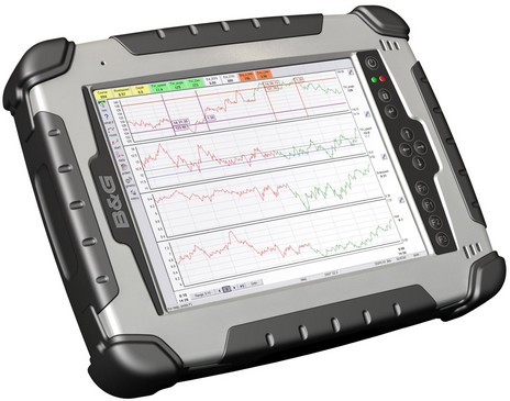
Being a bit of contrarian, I thought I’d put up another high-end display for Panbo’s nattering nabobs to fire upon (just kidding, fellas). Actually, I don’t know what this new RaceVision 3000 costs—B&G is apparently reticent about online prices—but I’d guess it’s a pretty dear 8.4” ruggedized, touch-screen, daylight-viewable tablet PC…

That’s the hind end of an AmbientNAV 17” Alpha monitor, just announced but not yet up at the company site. Check the bigger shot to see the amazing diversity of inputs available, not to mention the sharp engineering. Yup, that’s a coax connector at right, leading to the built-in HD sat TV tuner. I don’t normally get into pricing, but…


