
The raster flow begins, a CE first?
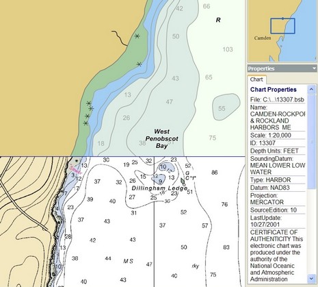
Rose Point Navigation just announced that Coastal Explorer is “the first program to include the entire NOAA chart collection covering all US waters.” What they mean is a sort of mulligan stew of cartography—500 ENC vector charts, 250 “Vector Coastal Explorer Charts” (which I think are actually derived from the DNC portfolio put together by NGA, the National Geospatial-Intelligence Agency, and also available from SoftChart for use with Capn 8.0), and 250 raster charts. In other words, they’re covering every bit of US coast at every available scale, but they’re not providing double coverage—raster and vector. By contrast, SoftChart is providing double and sometimes triple (two kinds of vector) coverage of many areas (at $200 per region), which can be darn useful for maximum detail and readability (I often cruise in Maine with both a vector and raster charts visible in split screen mode). I also noticed that CE has a little trouble perfectly quilting all three chart types, at least in my area, though below you can see how well it can do too.
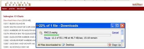
But this is quibbling when you consider that Rose Point is including all 1,000 charts with its very able charting program, all for $400 total. The rasters will soon be on the shipping CD (DVD?) package, and are available for download now (though, as shown above, you need broadband). How did Rose Point get their mitts on these charts before NOAA has even started distributing them on its Web site? A good question, and the answer is about to reveal itself! And, by the way, can the worldwide portfolio of DNC vector charts, which seem to be downloadable, be used by the public? I really don’t know, but sure am curious.


")


Mac ENC 2.0 supports and includes vector and raster charts for the entire United States. Link shows raster chart on top of vector chart.
The benefit of this is you get the vector data base information about any navigation aid for the raster chart.
http://www.gpsnavx.com/MacENC/images/screenraster.jpg
It is to bad that they do not include the entire raster chart set. As Ben noted, side by side is often valuble, especially in s strange port. The lack of detail in ENCs can be discerning.
You can download all the Raster charts from the Maptech site now – just make sure you have a high bandwidth connection.
Dave
NOAA is also offering the BSB charts for free..
http://nauticalcharts.noaa.gov/mcd/Raster/Index.htm